Area Overview for Didsbury West Ward
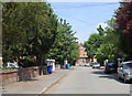
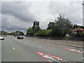
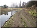
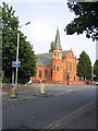
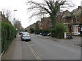
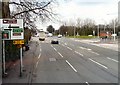
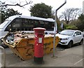
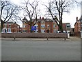
Photos of Didsbury West Ward


Area Information
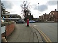
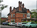
Living in Didsbury West Ward Didsbury West Ward serves as a populated locality within the Manchester metropolitan borough, returning three councillors to the council. The ward sits at coordinates approximately 53.4186°N 2.2431°W and forms part of the Manchester Withington parliamentary constituency. With a total area of 3.4 km², the ward contains a population established in 2021 of 15,083. Residents can expect a specific demographic profile characterised by an older population median age of 70 years. This suggests a community dominated by older adults, retirees, and long-term residents rather than young families or professionals just entering the housing market. The ward functions as a defined electoral boundary with clear administrative responsibilities centred around its geographical centre. You see 15,083 people living within these boundaries, creating a dense residential environment in a relatively compact space. The ward's structure means services are delivered through Manchester City Council, ensuring local representation and governance. Understanding this basic layout helps you grasp the scale of the community you are considering. It is a ward with a specific character driven by its age demographics and limited land area. If you are looking at homes in Didsbury West Ward, you are entering an area where the social fabric is shaped by this older population. The ward's definition ties it closely to the wider Didsbury brand but maintains its own distinct identity as an electoral unit. The ward hosts three councillors who represent the interests of the 15,083 residents. This political structure ensures that local planning and policy decisions are handled at a ward level before being escalated to the borough or city. Location-wise, the coordinates place the ward securely within Greater Manchester. This positioning influences local transport links and service provision. You will find that daily life here revolves around established neighbourhood patterns consistent with the older demographic profile. The ward falls under the Manchester Withington constituency for MP elections. This broader political context often influences funding and development projects. The specific area size of 3.4 km² means resources are concentrated in a fairly defined footprint.
- Area Type
- District Borough Unitary Ward
- Area Size
- 3.4 km²
- Population
- Not available
- Population Density
- Not available
Demographics
Community and Demographics The population of Didsbury West Ward is distinctly older than the national average, with a median age of 70. This figure indicates that half of the residents are aged 70 or above. The most common age bracket simply listed as "Age: Total" in records highlights the broad statistical focus on the entire population rather than specific subgroups. You are looking at a community where senior citizens and mature residents form the core of life in Didsbury West Ward. Home ownership stands at exactly 50%, a precise figure that paints a specific picture of property tenure. Half of the households in this 15,083-strong population own their homes outright or have a mortgage, while the other half rent or live with family. This even split means you will see a mix of private property owners and tenants within the ward. It is not an overwhelmingly owner-occupied estate in the way some older suburbs might be, nor is it a purely private rental zone. Accommodation types and household composition are recorded but the data summarises them broadly. The ward does not have a single dominant housing style visible in the raw text provided, though the age profile often correlates with multi-generational living or larger detached homes. You might find that many households are multi-person units catering to older people living with partners or children. Ethnic diversity and predominant religious groups are flagged in the data but not broken down with specific percentages. The area reflects the broader trend of Manchester's diverse population, yet the specific breakdown for Didsbury West Ward is not available in this extract. This means you cannot assign a specific ethnic identity to the ward based solely on this dataset. When you assess the quality of life, the deprivation level must be considered in context. While direct deprivation indices are not explicitly stated as "high" or "low" in the provided text, the age profile and half-share of owner-occupied homes suggest a stable, settled community. The demographic data does not show extreme youth unemployment or high poverty rates typically associated with younger, transient populations. Whether you are buying or renting, understanding that 50% of residents own their homes provides a solid baseline. It suggests a community with significant ties to the area. The ward's demographics indicate a place of stability rather than rapid turnover. The household composition data points to a society where traditions of domestic life remain strong. Older residents often maintain long-standing household structures. This stability can make the area attractive to those seeking quiet surroundings rather than bustling nightlife.
Household Size
Accommodation Type
Tenure
Ethnic Group
Religion
Household Composition
Age
Household Deprivation
NS-SEC
Explore more demographic insights in this area
Go to Demographics tabPlanning
Planning Constraints
- Flood RiskPremium
- Ramsar Wetland SitesPremium
- Area of Outstanding Natural BeautyPremium
- Protected Nature ReservePremium
- Protected WoodlandPremium