Area Overview for Didsbury East Ward
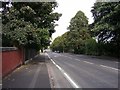
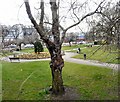
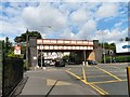
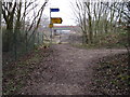
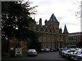
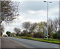
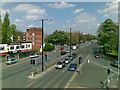
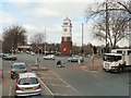
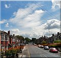
Photos of Didsbury East Ward


Area Information
Living in Didsbury East Ward offers a distinctive experience defined by its compact footprint and established character. This district occupies just 3.7 km² within Greater Manchester, creating a tightly knit community feel unlike larger suburban sprawls. You will find that daily life revolves around proximity; with 1,590 residents, the area maintains a residential density of 434 people per square kilometre. This concentration supports a neighbourhood where facilities feel accessible without the overwhelming crowds of major city centres. The ward represents a specific slice of Didsbury that balances quiet domesticity with the convenience of urban amenities nearby. Prospective buyers often note that the limited land area means development is constrained, preserving the existing layout and green spaces within these boundaries. It is a place where the average journey to the centre of the ward takes only a few minutes on foot or by cycle. The absence of significant planning constraints, such as protected woodlands or nature reserves within the boundaries, allows for a straightforward residential environment. Families and individuals seeking a defined boundary to their home life will appreciate the clear limits of this 3.7 km² zone. You enter a structured community where the local geography dictates a slow pace of life centred on home rather than traffic.
- Area Type
- District Borough Unitary Ward
- Area Size
- 3.7 km²
- Population
- 1590
- Population Density
- 434 people/km²
Demographics
The community profile of Didsbury East Ward reveals an area dominated by older residents. The median age stands at exactly 70 years, marking this as one of the oldest wards in the Didsbury vicinity. When you examine household composition, the high median age suggests that many homes support retirees or empty-nesters rather than young families raising children. Most common age ranges reflect this senior demographic, shaping local demand for amenities like healthcare and leisure facilities rather than playgrounds. Home ownership is a defining feature, with 68% of residents owning their property outright or through a mortgage. This ownership rate significantly outpaces national averages and indicates a stable, long-term resident base. You will encounter very few new-build developments or high-rise rental blocks, as the accommodation types reflect a traditional housing stock suited to older occupants. There are no complex ethnic breakdowns or religion statistics available in current records, so the social fabric remains defined by age rather than diversity metrics. The household composition data confirms that few single-parent households or large multi-generational families exist here. This demographic reality means that if you are looking to buy, you are entering a market heavily influenced by the needs of older buyers. Local schools near Didsbury East Ward may serve fewer local children compared to wards with younger populations, potentially affecting catchment dynamics. The deprivation data is not explicitly broken down in this specific dataset, but the age profile alone suggests a community that relies on specific public services different from those in younger areas.
Household Size
Accommodation Type
Tenure
Ethnic Group
Religion
Household Composition
Age
Household Deprivation
NS-SEC
Explore more demographic insights in this area
Go to Demographics tabPlanning
Planning Constraints
- Flood RiskPremium
- Ramsar Wetland SitesPremium
- Area of Outstanding Natural BeautyPremium
- Protected Nature ReservePremium
- Protected WoodlandPremium