Area Overview for Derby Ward
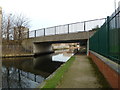
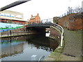
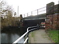
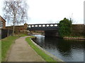
Photos of Derby Ward
Area Information
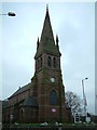
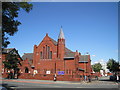
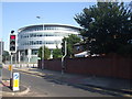
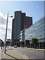
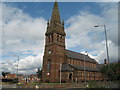
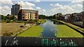
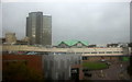
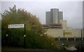
The Abbey ward in Derby is a compact district covering just 2.2 sq km, home to a population of 3,380 residents. This area represents one of the more densely populated parts of the city, situated immediately west and south-west of the urban centre. The ward encompasses distinct neighbourhoods including California, Rowditch, and St Lukes, all bordered by the Outer Ring Road and Abbey Street. You will find Victorian terraced housing near the city limits blending with mid-20th century suburban estates closer to the ring road. California specifically offers detached and semi-detached homes that were developed after the construction of the Outer Ring Road in 1928. The layout provides a mix of older Victorian architecture and more modern suburban layouts. Living in Derby Ward means navigating a mature, established urban environment where the backdrop includes significant transport routes like Burton Road. The area carries historical significance, with Rowditch originatinig as a medieval hamlet on the Roman route of Icknield Street. Some parts of the ward, formerly known as Abbey Barns, were once arable land owned by the Abbey of Darley before urbanisation took hold. While the ward profile data lists a population of 3,380, broader research indicates the wider Abbey area sustains a much larger population of over 15,000 people. The density here is significant, with 1,538 people living per square kilometre in this specific ward. You can expect a typical city neighbourhood where daily life revolves around proximity to the city centre and established road networks. The area includes St. Luke's Church as a notable community feature.
- Area Type
- District Borough Unitary Ward
- Area Size
- 2.2 km²
- Population
- 3380
- Population Density
- 1538 people/km²
Demographics
The community profile of Derby Ward reveals a distinct demographic skew towards later life. The median age for residents is 70, indicating that this is primarily an area for older adults, retirees, or senior households. This age distribution means the local shops and services are likely tailored to the needs of an older population rather than young families or students. With a home ownership rate of 44%, nearly half of the households own their property outright or with a mortgage. The remaining 56% of households reside in rented accommodation, suggesting a significant proportion of the population relies on tenancies or social housing. The ward does not display specific data regarding ethnicity or religion in the current reports, so the ethnic diversity cannot be quantified from available figures. Similarly, detailed breakdowns of household composition types beyond the total are not provided in the dataset. Despite the lack of granular data on income levels or deprivation statistics, the age profile offers clear insight into the nature of the community. You are looking at an area where the workforce participation rates may be lower due to the age of the residents. The high population density of 1,538 people per square kilometre suggests that homes are clustered relatively close together. If you are considering buying homes in Derby Ward, be aware that you may find a quieter environment dominated generally by older residents rather than a bustling mix of young professionals and families. The historical context of the area, with roots in medieval Roman routes, contrasts with the modern demographic realities of today's larger population figures for the wider ward.
Household Size
Accommodation Type
Tenure
Ethnic Group
Religion
Household Composition
Age
Household Deprivation
NS-SEC
Explore more demographic insights in this area
Go to Demographics tabPlanning
Planning Constraints
- Flood RiskPremium
- Ramsar Wetland SitesPremium
- Area of Outstanding Natural BeautyPremium
- Protected Nature ReservePremium
- Protected WoodlandPremium
- Crime RiskPremium