Area Overview for Deepdale Ward
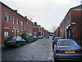
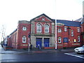
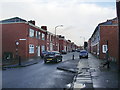
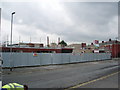
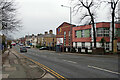
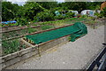
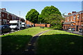
Photos of Deepdale Ward


Area Information
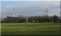
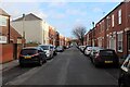
Deepdale Ward is a compact district covering 1.4 km² within the district borough unitary setup of England. It serves a population of 1,811 residents, resulting in a population density of 1,311 people per square kilometre. This sizeable density means services and properties are located in close proximity to one another. Daily life here centres on a defined residential zone where you are surrounded by neighbours rather than open sprawl. The area functions as a self-contained unit, meaning most of your routine needs are met within these boundaries. You will find a community structure that supports around 1,800 individuals in a focused setting. The ward represents a specific slice of the local housing market, distinct from larger urban districts. Its physical footprint creates an environment where every resident shares a sense of location. This concentration of homes defines the character of the neighbourhood. You live among peers in an area where the community is well-defined and known to one another. The limited land area ensures that you do not travel far for the basics of a settled life.
- Area Type
- District Borough Unitary Ward
- Area Size
- 1.4 km²
- Population
- 1811
- Population Density
- 1311 people/km²
Demographics
The community profile of Deepdale Ward reveals a significant shift towards older age brackets. The median age across the ward stands at 70 years, indicating that the average household head is well past retirement age. This demographic skew suggests that the local population relies heavily on pensions rather than active employment income. Over half of the households, specifically 58%, are owner-occupiers. This high rate of ownership points to a long-standing residential community where families have secured their property interests. The remaining 42% of households consist of renters or those with different tenure arrangements. Accommodation types vary within the ward to serve this older demographic, though specific breakdowns by dwelling type are not detailed here. The age range data confirms that the total population leans heavily towards the senior category. Deprivation factors are not explicitly quantified in the current dataset, but the high home ownership rate typically correlates with stable neighbourhoods. You are looking at an area where the residents have largely put down roots over many years. The social fabric is built around people who have lived here for decades, creating a quiet and established atmosphere.
Household Size
Accommodation Type
Tenure
Ethnic Group
Religion
Household Composition
Age
Household Deprivation
NS-SEC
Explore more demographic insights in this area
Go to Demographics tabPlanning
Planning Constraints
- Flood RiskPremium
- Ramsar Wetland SitesPremium
- Area of Outstanding Natural BeautyPremium
- Protected Nature ReservePremium
- Protected WoodlandPremium