Area Overview for Dearham
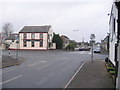
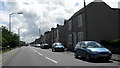
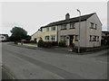
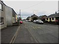
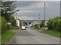
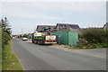
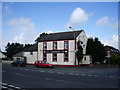
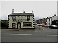
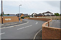
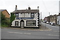
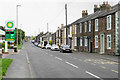
Photos of Dearham
Area Information
Dearham is a built-up area of 68.2 hectares in England, characterised by its mature demographic profile and practical infrastructure. With a median age of 70, it reflects a community of long-term residents, many of whom own their homes—78% of households are owner-occupied. Daily life here is shaped by proximity to essential services, including three railway stations: Maryport, Flimby, and Aspatria. These provide reliable access to nearby towns and cities, while five retail outlets, including Spar and Tesco Maryport, cater to everyday needs. The area’s safety is notable, with a low crime risk score of 85, reinforcing its appeal for those prioritising security. For families, the presence of Dearham Primary School, rated outstanding by Ofsted, ensures high-quality education is within reach. The blend of modest area size, established community, and accessible amenities makes Dearham a practical choice for those seeking stability and convenience.
- Area Type
- Built Up Area 250
- Area Size
- 68.2 hectares
- Population
- Not available
- Population Density
- Not available
Daily life in Dearham is shaped by its accessible amenities, including five retail outlets such as Spar and Tesco Maryport. These stores provide essentials, from groceries to convenience items, within practical reach. The three railway stations—Maryport, Flimby, and Aspatria—enhance mobility, offering connections to nearby hubs for shopping, leisure, or commuting. While the area lacks detailed data on parks or leisure facilities, the presence of retail and rail infrastructure suggests a lifestyle focused on practicality and connectivity. The combination of local shops and reliable transport options makes Dearham suitable for those prioritising convenience over expansive recreational spaces.
Amenities
Schools
Dearham Primary School is the only named educational institution in the area, serving as the sole primary school for local children. It holds an outstanding Ofsted rating, a rare distinction that highlights its quality of education and facilities. While no secondary schools are listed, the presence of a top-rated primary school ensures families have access to high standards of early education. This is particularly valuable for parents prioritising academic outcomes, though those requiring secondary schooling may need to look beyond the immediate vicinity. The school’s rating reflects well on the area’s commitment to education, though the limited range of school types means families should plan for additional travel if higher education is a priority.
| Rank | School | Type | Entry gender | Ages |
|---|
Explore more schools in this area
Go to Schools tabDemographics
The population of Dearham has a median age of 70, reflecting a community skewed toward older adults. This is the most common age range, suggesting a settled, long-term resident base. Home ownership is high at 78%, indicating a predominantly owner-occupied area with fewer rental properties. The data does not specify household composition or accommodation types, but the overall profile points to a cohesive, mature demographic. While no specific figures on diversity or deprivation are provided, the high home ownership rate and low crime risk imply a stable, low-pressure environment. For residents, this translates to a lifestyle focused on continuity rather than rapid change, with amenities and services tailored to the needs of an older population.
Household Size
Accommodation Type
Tenure
Ethnic Group
Religion
Household Composition
Age
Household Deprivation
NS-SEC
Explore more demographic insights in this area
Go to Demographics tabPlanning
Planning Constraints
- Crime RiskPremium