Area Overview for Deansgate Ward
Photos of Deansgate Ward

Area Information
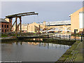
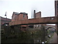
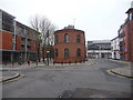
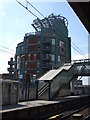
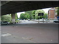
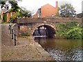
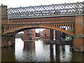
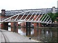
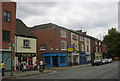
Living in Deansgate Ward offers a distinct experience within the heart of Manchester city centre. This electoral ward covers a small area of just 2.0 km² yet contains a population of 1,025 residents. The location is defined by Deansgate, a main road and part of the A56 that runs roughly north to south through Manchester's western city centre. The ward sits largely within the Manchester Central parliamentary constituency, with the section north of the railway line through Victoria station falling under Blackley and Broughton. You will find yourself surrounded by red brick industrial buildings that now house cocktail bars and craft venues. This blend of historic and contemporary uses combines retail, hospitality, and commercial functions within a dense urban environment. The street has evolved from a rural road in the 1730s into one of the oldest, most vibrant streets in Manchester. Today, the area hosts major landmarks including the Great Northern Warehouse and the Beetham Tower. While the northern end was damaged during the Manchester Blitz in December 1940 and the 1996 bombing, subsequent redevelopment has created a unique city-centre environment. Digital connectivity is robust, with a score indicating excellent fixed broadband quality for remote working. However, the compact nature of this district means you are immersed in a bustling commercial zone rather than a traditional suburban neighbourhood.
- Area Type
- District Borough Unitary Ward
- Area Size
- 2.0 km²
- Population
- 1025
- Population Density
- 517 people/km²
Demographics
The community profile of Deansgate Ward presents specific characteristics regarding age and housing tenure. The median age of residents is 70, indicating an older population compared to many city centres. This demographic skew suggests the ward attracts retirees or those looking for a quiet life away from the faster pace of other Manchester districts. Home ownership stands at 24%, which is relatively low and suggests the area functions primarily as a rental market or a place for investment properties rather than family estates. The data does not specify the breakdown of household composition by age range, though the median age provides a clear indicator of the demographic weight. Similarly, while the ward contains a mix of retail, hospitality, and commercial functions, the residential population size is modest at 1,025 people across just 2.0 km². This results in a population density of 517 people per square kilometre, creating a urban feel without widespread sprawl. The diversity data for predominant ethnic group and religion is not available in the current dataset, but the concentration of independent bars and craft venues suggests a cultural focus on nightlife and leisure rather than traditional community institutions.
Household Size
Accommodation Type
Tenure
Ethnic Group
Religion
Household Composition
Age
Household Deprivation
NS-SEC
Explore more demographic insights in this area
Go to Demographics tabPlanning
Planning Constraints
- Flood RiskPremium
- Ramsar Wetland SitesPremium
- Area of Outstanding Natural BeautyPremium
- Protected Nature ReservePremium
- Protected WoodlandPremium