Area Overview for CW9 7EX
Photos of CW9 7EX
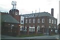
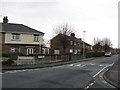
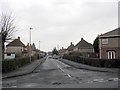
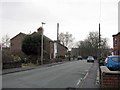
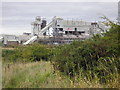
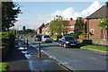
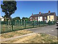
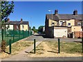


28 photos from this area
Area Information
Key information about the CW9 7EX including its size, population, and administrative classification.
- Area Type
- Postcode
- Area Size
- 5200 m²
- Population
- 1471
- Population Density
- 5172 people/km²
House Prices in CW9 7EX
20
Properties
£125,864
Average Sold Price
£30,000
Lowest Price
£235,000
Highest Price
Showing 20 properties
| Address | Type | Beds | Baths | Last Sale Price | Last Sale Date | |
|---|---|---|---|---|---|---|
| 31 Shipbrook Road, Rudheath, Northwich, CW9 7EX | house | 3 | - | £173,500 | Jul 2022 | |
| 17 Shipbrook Road, Rudheath, Northwich, CW9 7EX | Semi-detached | 2 | - | £145,000 | Aug 2021 | |
| 27 Shipbrook Road, Rudheath, Northwich, CW9 7EX | house | - | - | £147,000 | Mar 2020 | |
| 25 Shipbrook Road, Rudheath, Northwich, CW9 7EX | Semi-detached | 3 | 1 | £115,500 | Feb 2018 | |
| 53 Shipbrook Road, Rudheath, Northwich, CW9 7EX | Detached | 3 | 1 | £205,000 | Apr 2014 | |
| 23 Shipbrook Road, Rudheath, Northwich, CW9 7EX | house | - | - | £125,000 | Dec 2013 | |
| 49 Shipbrook Road, Rudheath, Northwich, CW9 7EX | Detached | - | - | £235,000 | Nov 2012 | |
| 39 Shipbrook Road, Rudheath, Northwich, CW9 7EX | Semi-detached | - | - | £102,500 | Feb 2004 | |
| 19 Shipbrook Road, Rudheath, Northwich, CW9 7EX | Semi-detached | - | - | £52,000 | Jan 1999 | |
| 41 Shipbrook Road, Rudheath, Northwich, CW9 7EX | Semi-detached | 3 | 1 | £54,000 | Dec 1998 |
Page 1 of 2
Energy Efficiency in CW9 7EX
Amenities
Schools
| Rank | School | Type | Entry gender | Ages |
|---|
Explore more schools in this area
Go to Schools tabDemographics
Household Size
Two person
most common
Accommodation Type
Houses
most common
Tenure
72
majority
Ethnic Group
White
most common
Religion
N/A
most common
Household Composition
N/A
most common
Age
47
median
Adults (30-64 years)
most common
Household Deprivation
N/A
with no deprivation
NS-SEC
26
in Lower managerial occupations
Explore more demographic insights in this area
Go to Demographics tabPlanning
Planning Constraints
- Flood RiskPremium
- Ramsar Wetland SitesPremium
- Area of Outstanding Natural BeautyPremium
- Protected Nature ReservePremium
- Protected WoodlandPremium