Area Overview for CW9 7ES
Photos of CW9 7ES
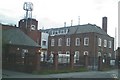
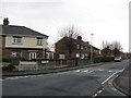
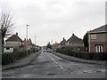
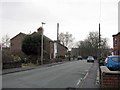

28 photos from this area
Area Information
Key information about the CW9 7ES including its size, population, and administrative classification.
- Area Type
- Postcode
- Area Size
- 1.6 hectares
- Population
- 1753
- Population Density
- 4581 people/km²
House Prices in CW9 7ES
29
Properties
£152,875
Average Sold Price
£42,000
Lowest Price
£238,000
Highest Price
Showing 29 properties
| Address | Type | Beds | Baths | Last Sale Price | Last Sale Date | |
|---|---|---|---|---|---|---|
| 62 West Avenue, Rudheath, Northwich, CW9 7ES | Semi-detached | 3 | 1 | £238,000 | Dec 2023 | |
| 80 West Avenue, Rudheath, Northwich, CW9 7ES | Retail | 2 | 1 | £195,000 | Oct 2022 | |
| 50 West Avenue, Rudheath, Northwich, CW9 7ES | house | - | - | £210,000 | Jul 2022 | |
| 70 West Avenue, Rudheath, Northwich, CW9 7ES | Detached | 3 | 2 | £200,000 | Dec 2021 | |
| 63 West Avenue, Rudheath, Northwich, CW9 7ES | house | - | - | £152,500 | Apr 2021 | |
| 74 West Avenue, Rudheath, Northwich, CW9 7ES | Semi-detached | - | - | £70,000 | Apr 2020 | |
| 67 West Avenue, Rudheath, Northwich, CW9 7ES | house | - | - | £159,000 | Jun 2019 | |
| 65 West Avenue, Rudheath, Northwich, CW9 7ES | house | 3 | - | £150,000 | Jan 2018 | |
| 54 West Avenue, Rudheath, Northwich, CW9 7ES | Semi-detached | 5 | 1 | £145,000 | Jul 2017 | |
| 75 West Avenue, Rudheath, Northwich, CW9 7ES | Semi-detached | 4 | 2 | £156,000 | Feb 2013 |
Page 1 of 3
Energy Efficiency in CW9 7ES
Amenities
Schools
| Rank | School | Type | Entry gender | Ages |
|---|
Explore more schools in this area
Go to Schools tabDemographics
Household Size
Two person
most common
Accommodation Type
Houses
most common
Tenure
63
majority
Ethnic Group
White
most common
Religion
N/A
most common
Household Composition
N/A
most common
Age
47
median
Adults (30-64 years)
most common
Household Deprivation
N/A
with no deprivation
NS-SEC
23
in Lower managerial occupations
Explore more demographic insights in this area
Go to Demographics tabPlanning
Planning Constraints
- Flood RiskPremium
- Ramsar Wetland SitesPremium
- Area of Outstanding Natural BeautyPremium
- Protected Nature ReservePremium
- Protected WoodlandPremium