Area Overview for CW9 5RT
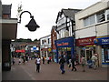
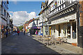
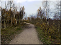
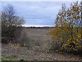
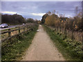
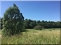
Photos of CW9 5RT


Area Information
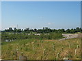
CW9 5RT is a small residential postcode area nestled in Northwich, a historic market town on the Cheshire Plain. With a population of 1,978 spread across 1.5 hectares, the area is densely populated, reflecting the compact nature of its housing stock. Northwich itself has a legacy as a salt-producing site, a history that continues to shape its character today. The area is well-served by transport links, including multiple railway stations within practical reach, and is close to the River Weaver, which has long been central to the town’s economy. Daily life here is defined by proximity to retail and community hubs, with Sainsburys Northwich and Lidl Greenbank among the notable shops. The demographic profile suggests a mature community, with a median age of 47 and a strong presence of adults aged 30–64. This mix of residents contributes to a settled, localised atmosphere, though the area’s small size means its immediate surroundings are key to understanding its full character.
- Area Type
- Postcode
- Area Size
- 1.5 hectares
- Population
- 1978
- Population Density
- 1546 people/km²
The property market in CW9 5RT is characterised by a predominance of houses, with 39% of residents owning their homes. This suggests a balance between owner-occupied properties and rental stock, though the exact proportion of rentals is not specified. Given the area’s small size and high population density, the housing stock is likely to be tightly packed, with limited scope for expansion. Buyers should consider that the market is not dominated by high-end properties or luxury homes, reflecting the area’s modest scale. Proximity to Northwich’s amenities and transport links may make it attractive to those seeking a compact, well-connected living environment. However, the small footprint of the postcode means that property values and availability are closely tied to the broader Northwich market, which could have implications for investment or long-term residency.
House Prices in CW9 5RT
Showing 2 properties
| Address | Type | Beds | Baths | Last Sale Price | Last Sale Date | |
|---|---|---|---|---|---|---|
| Sainsburys, Petrol Filling Station, Venables Road, Northwich, CW9 5RT | Retail | - | - | - | - | |
| Sainsburys, Petrol Filling Station, Venables Road, Northwich, CW9 5RT | retail_financial | - | - | - | - |
Energy Efficiency in CW9 5RT
The lifestyle in CW9 5RT is shaped by its proximity to retail, dining, and transport hubs. Nearby amenities include Sainsburys Northwich, Iceland Northwich, and Lidl Greenbank, providing access to groceries and everyday essentials. The area’s railway stations—Northwich, Greenbank, and Lostock Gralam—offer connections to larger towns and cities, enhancing mobility. While the data does not mention parks or leisure facilities explicitly, the historical significance of Northwich, including its role in salt production, suggests a town with cultural and industrial heritage. The compact nature of the postcode means that residents can reach these amenities quickly, contributing to a convenient, community-focused lifestyle. The mix of retail and transport options supports both practical needs and the potential for social engagement within the local area.
Amenities
Schools
The schools near CW9 5RT include two primary schools: Victoria Road Primary School and Witton Church Walk CofE Aided Nursery and Primary School. Both institutions have an Ofsted rating of 'good', indicating a reliable standard of education for younger children. The presence of two primary schools within the area suggests that families with young children have access to multiple options, though no secondary schools are listed in the data. This could mean that students must travel to nearby towns for secondary education, which is a practical consideration for parents. The 'good' Ofsted ratings imply that the local schools are performing adequately, but the lack of secondary education options within the immediate area may influence decisions about where to live.
| Rank | School | Type | Entry gender | Ages |
|---|
Explore more schools in this area
Go to Schools tabDemographics
The community in CW9 5RT is predominantly composed of adults aged 30–64, with a median age of 47, reflecting a mature demographic. Home ownership here is relatively low, at 39%, indicating a mix of owner-occupied properties and rental units. The accommodation type is primarily houses, which is notable given the area’s compact size. The predominant ethnic group is White, and no specific data is provided on diversity beyond this. The population density of 1,546 people per square kilometre suggests a tightly knit, urbanised environment. While this density supports a vibrant local economy and access to services, it also means the area is highly dependent on nearby infrastructure. The absence of detailed deprivation data means the quality of life is best inferred from the availability of amenities and transport links, which appear to be reasonably robust.
Household Size
Accommodation Type
Tenure
Ethnic Group
Religion
Household Composition
Age
Household Deprivation
NS-SEC
Explore more demographic insights in this area
Go to Demographics tabPlanning
Planning Constraints
- Flood RiskPremium
- Ramsar Wetland SitesPremium
- Area of Outstanding Natural BeautyPremium
- Protected Nature ReservePremium
- Protected WoodlandPremium