Area Overview for CW9 5JG
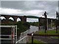
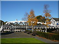
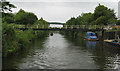
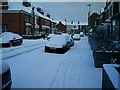
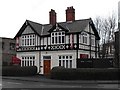
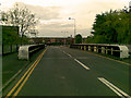
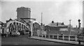
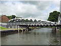
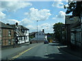
Photos of CW9 5JG


Area Information
Living in CW9 5JG means being part of a small, densely populated residential cluster in Northwich, Cheshire. With a population of 1,978 and a density of 1,546 people per square kilometre, this postcode area reflects a compact, community-focused environment. Historically a salt-producing town, Northwich’s legacy is woven into its modern identity, with the River Weaver shaping its geography. The area’s proximity to nearby towns like Middlewich and Nantwich adds to its regional connectivity. Daily life here is characterised by a mix of traditional and contemporary influences, from historic market town charm to modern amenities. The presence of primary schools, retail outlets, and rail links ensures practicality for families and commuters. While the community is small, it offers a blend of residential stability and access to broader networks, making it a viable choice for those seeking a balanced lifestyle in a historically rich part of Cheshire.
- Area Type
- Postcode
- Area Size
- Not available
- Population
- 1978
- Population Density
- 1546 people/km²
The property market in CW9 5JG is characterised by a 39% home ownership rate, which is notably lower than the national average. This suggests that the area is more rental-focused, with many residents living in privately rented properties rather than owning their homes. The predominant accommodation type is houses, which are typically larger and more spread out than flats, reflecting the traditional suburban or semi-rural layout of Northwich. For buyers, this means a limited pool of owner-occupied homes, potentially requiring a broader search beyond the immediate postcode area. The small size of the residential cluster also means that property availability is constrained, and competition for available homes may be higher. Those considering purchase should factor in the need to look further afield for a wider selection of housing options.
House Prices in CW9 5JG
No properties found in this postcode.
Energy Efficiency in CW9 5JG
The lifestyle in CW9 5JG is shaped by its proximity to retail and transport hubs. Nearby shops include Farmfoods Northwich, Waitrose Northwich, and Iceland Northwich, offering a range of grocery and convenience options. These stores cater to daily needs, reducing the necessity for long trips to larger centres. The rail network provides access to broader leisure and employment opportunities, with stations like Northwich and Lostock Gralam linking to cultural and commercial areas. While the area lacks detailed information on parks or leisure facilities, the presence of multiple retail outlets and rail links suggests a practical, service-oriented lifestyle. Residents can enjoy a mix of local shopping and regional connectivity, though the absence of specific recreational amenities may require travel for more extensive leisure activities.
Amenities
Schools
Residents of CW9 5JG have access to three primary schools within practical reach. Victoria Road Primary School and Witton Church Walk CofE Aided Nursery and Primary School are both primary institutions, with the latter holding a ‘good’ Ofsted rating. The duplication of Victoria Road Primary School in the data may indicate a local emphasis on primary education, though specific details about their curricula or facilities are not provided. The presence of two primary schools suggests that families with young children have multiple options for schooling, though the absence of secondary schools within the area may require commuting to nearby towns. The ‘good’ rating at Witton Church Walk highlights a reliable educational option, which is a key consideration for parents evaluating the area’s suitability for raising children.
| Rank | School | Type | Entry gender | Ages |
|---|
Explore more schools in this area
Go to Schools tabDemographics
CW9 5JG has a median age of 47, with the majority of residents aged between 30 and 64. This suggests a community skewed toward adults, likely including families with children and older professionals. Home ownership rates are relatively low at 39%, indicating that a significant portion of the population rents their homes. The area is predominantly composed of houses, not flats, which aligns with the traditional housing stock of Northwich. The predominant ethnic group is White, reflecting the broader demographic trends of the region. While deprivation data is not explicitly provided, the low home ownership rate may imply a reliance on rental markets or shared living arrangements. The age profile suggests a stable, mature community, though the lack of younger residents could impact local services and schools.
Household Size
Accommodation Type
Tenure
Ethnic Group
Religion
Household Composition
Age
Household Deprivation
NS-SEC
Explore more demographic insights in this area
Go to Demographics tabPlanning
Planning Constraints
- Flood RiskPremium
- Ramsar Wetland SitesPremium
- Area of Outstanding Natural BeautyPremium
- Protected Nature ReservePremium
- Protected WoodlandPremium