Area Overview for CW8 1QN
Photos of CW8 1QN
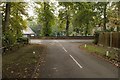

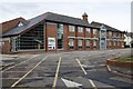

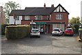
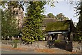

30 photos from this area
Area Information
Key information about the CW8 1QN including its size, population, and administrative classification.
- Area Type
- Postcode
- Area Size
- 3.6 hectares
- Population
- 2042
- Population Density
- 1140 people/km²
House Prices in CW8 1QN
34
Properties
£514,256
Average Sold Price
£143,000
Lowest Price
£999,995
Highest Price
Showing 34 properties
| Address | Type | Beds | Baths | Last Sale Price | Last Sale Date | |
|---|---|---|---|---|---|---|
| 5 Walnut Lane, Hartford, Northwich, CW8 1QN | Detached | 5 | 1 | £725,000 | Feb 2025 | |
| 19 Walnut Lane, Hartford, Northwich, CW8 1QN | Detached | 4 | 2 | £950,000 | Jul 2023 | |
| Larks Rise, Walnut Lane, Hartford, Northwich, CW8 1QN | house | - | - | £350,000 | Jan 2019 | |
| 16 Walnut Lane, Hartford, Northwich, CW8 1QN | house | - | - | £510,000 | Oct 2017 | |
| 6 Walnut Lane, Hartford, Northwich, CW8 1QN | Detached | 4 | 4 | £784,995 | Aug 2016 | |
| 4 Walnut Lane, Hartford, Northwich, CW8 1QN | Detached | 4 | 1 | £999,995 | Jun 2016 | |
| 1A Walnut Lane, Hartford, Northwich, CW8 1QN | house | - | - | £490,000 | Jun 2016 | |
| 2 Walnut Lane, Hartford, Northwich, CW8 1QN | house | - | - | £774,995 | Mar 2016 | |
| 22 Walnut Lane, Hartford, Northwich, CW8 1QN | house | - | - | £260,000 | Feb 2015 | |
| 11 Walnut Lane, Hartford, Northwich, CW8 1QN | Detached | - | - | £535,000 | Nov 2012 |
Page 1 of 4
Energy Efficiency in CW8 1QN
Amenities
Schools
| Rank | School | Type | Entry gender | Ages |
|---|
Explore more schools in this area
Go to Schools tabDemographics
Household Size
Two person
most common
Accommodation Type
Houses
most common
Tenure
89
majority
Ethnic Group
White
most common
Religion
N/A
most common
Household Composition
N/A
most common
Age
47
median
Adults (30-64 years)
most common
Household Deprivation
N/A
with no deprivation
NS-SEC
50
in Lower managerial occupations
Explore more demographic insights in this area
Go to Demographics tabPlanning
Planning Constraints
- Flood RiskPremium
- Ramsar Wetland SitesPremium
- Area of Outstanding Natural BeautyPremium
- Protected Nature ReservePremium
- Protected WoodlandPremium