Area Overview for CW7 4EL
Photos of CW7 4EL
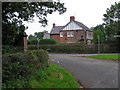
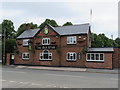
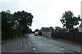
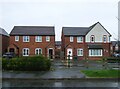
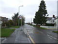
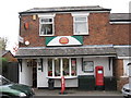
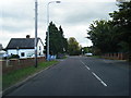
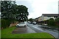
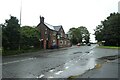
11 photos from this area
Area Information
Key information about the CW7 4EL including its size, population, and administrative classification.
- Area Type
- Postcode
- Area Size
- 3977 m²
- Population
- 1471
- Population Density
- 38 people/km²
House Prices in CW7 4EL
10
Properties
£203,994
Average Sold Price
£98,000
Lowest Price
£350,000
Highest Price
Showing 10 properties
| Address | Type | Beds | Baths | Last Sale Price | Last Sale Date | |
|---|---|---|---|---|---|---|
| 56 Moors Lane, Darnhall, Winsford, CW7 4EL | house | - | - | £317,500 | Feb 2022 | |
| 62 Moors Lane, Darnhall, Winsford, CW7 4EL | Detached | 4 | 1 | £350,000 | Mar 2021 | |
| 60 Moors Lane, Darnhall, Winsford, CW7 4EL | Detached | 3 | 2 | £200,000 | Jun 2019 | |
| 52 Moors Lane, Darnhall, Winsford, CW7 4EL | Detached | - | - | £166,000 | May 2006 | |
| 64 Moors Lane, Darnhall, Winsford, CW7 4EL | Detached | 4 | - | £179,500 | Sep 2002 | |
| 58 Moors Lane, Darnhall, Winsford, CW7 4EL | Detached | - | - | £176,000 | Jul 2002 | |
| 66 Moors Lane, Darnhall, Winsford, CW7 4EL | Detached | 5 | 1 | £144,950 | Mar 2000 | |
| 54 Moors Lane, Darnhall, Winsford, CW7 4EL | house | 4 | - | £98,000 | Mar 2000 | |
| 74 Moors Lane, Darnhall, Winsford, CW7 4EL | Detached | - | - | - | - | |
| 72 Moors Lane, Darnhall, Winsford, CW7 4EL | Detached | - | - | - | - |
Energy Efficiency in CW7 4EL
Amenities
Schools
| Rank | School | Type | Entry gender | Ages |
|---|
Explore more schools in this area
Go to Schools tabDemographics
Household Size
Two person
most common
Accommodation Type
Houses
most common
Tenure
74
majority
Ethnic Group
White
most common
Religion
N/A
most common
Household Composition
N/A
most common
Age
47
median
Adults (30-64 years)
most common
Household Deprivation
N/A
with no deprivation
NS-SEC
42
in Lower managerial occupations
Explore more demographic insights in this area
Go to Demographics tabPlanning
Planning Constraints
- Flood RiskPremium
- Ramsar Wetland SitesPremium
- Area of Outstanding Natural BeautyPremium
- Protected Nature ReservePremium
- Protected WoodlandPremium