Area Overview for CW7 4DN
Photos of CW7 4DN


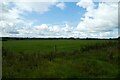

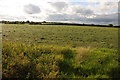
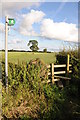
6 photos from this area
Area Information
Key information about the CW7 4DN including its size, population, and administrative classification.
- Area Type
- Postcode
- Area Size
- 1.1 km²
- Population
- 2058
- Population Density
- 53 people/km²
House Prices in CW7 4DN
30
Properties
£535,833
Average Sold Price
£25,000
Lowest Price
£1,200,000
Highest Price
Showing 30 properties
| Address | Type | Beds | Baths | Last Sale Price | Last Sale Date | |
|---|---|---|---|---|---|---|
| 3, Manor Farm Barns, Long Lane, Wettenhall, CW7 4DN | Semi-detached | 4 | 4 | £593,000 | Dec 2024 | |
| Cornhill Farm, Long Lane, Wettenhall, CW7 4DN | Land | 1 | - | £450,000 | Sep 2024 | |
| 2, Manor Farm Barns, Long Lane, Wettenhall, CW7 4DN | Semi-detached | 4 | 4 | £625,000 | Mar 2023 | |
| Corner Farm, Long Lane, Wettenhall, CW7 4DN | house | 3 | 2 | £1,200,000 | Jun 2022 | |
| Bank View, Long Lane, Wettenhall, CW7 4DN | Equestrian | 5 | - | £25,000 | Mar 2022 | |
| The Willows, Long Lane, Wettenhall, CW7 4DN | Bungalow | 4 | 1 | £780,000 | Aug 2020 | |
| Rosewood Farm, Long Lane, Wettenhall, CW7 4DN | Bungalow | 4 | 1 | £600,000 | Jul 2019 | |
| Oak Tree House, Long Lane, Wettenhall, CW7 4DN | Detached | 4 | 3 | £690,000 | Nov 2017 | |
| 5, Manor Farm Barns, Long Lane, Wettenhall, CW7 4DN | Semi-detached | 4 | - | £342,000 | Aug 2014 | |
| 1, Manor Farm Barns, Long Lane, Wettenhall, CW7 4DN | Terraced | - | - | £360,000 | Dec 2013 |
Page 1 of 3
Energy Efficiency in CW7 4DN
Amenities
Schools
| Rank | School | Type | Entry gender | Ages |
|---|
Explore more schools in this area
Go to Schools tabDemographics
Household Size
Two person
most common
Accommodation Type
Houses
most common
Tenure
81
majority
Ethnic Group
White
most common
Religion
N/A
most common
Household Composition
N/A
most common
Age
47
median
Young Adults (15-29 years)
most common
Household Deprivation
N/A
with no deprivation
NS-SEC
29
in Lower managerial occupations
Explore more demographic insights in this area
Go to Demographics tabPlanning
Planning Constraints
- Flood RiskPremium
- Ramsar Wetland SitesPremium
- Area of Outstanding Natural BeautyPremium
- Protected Nature ReservePremium
- Protected WoodlandPremium