Area Overview for CW7 4AS
Photos of CW7 4AS
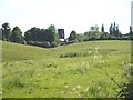
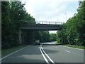
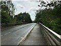

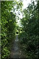
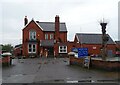
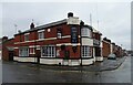
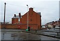
28 photos from this area
Area Information
Key information about the CW7 4AS including its size, population, and administrative classification.
- Area Type
- Postcode
- Area Size
- 3.7 hectares
- Population
- Not available
- Population Density
- Not available
House Prices in CW7 4AS
20
Properties
£147,634
Average Sold Price
£60,488
Lowest Price
£234,950
Highest Price
Showing 20 properties
| Address | Type | Beds | Baths | Last Sale Price | Last Sale Date | |
|---|---|---|---|---|---|---|
| 255 Ways Green, Winsford, CW7 4AS | Semi-detached | 3 | 3 | £164,000 | Apr 2022 | |
| 259 Ways Green, Winsford, CW7 4AS | house | - | - | £234,950 | Apr 2013 | |
| Brayton, Ways Green, Winsford, CW7 4AS | Bungalow | 2 | - | £124,000 | Sep 2012 | |
| Sandale, 265 Ways Green, Winsford, CW7 4AS | Semi-detached | 3 | 3 | £200,000 | Feb 2011 | |
| 257 Ways Green, Winsford, CW7 4AS | house | - | - | £140,000 | Apr 2009 | |
| Jendene, Ways Green, Winsford, CW7 4AS | Semi-detached | - | - | £60,488 | Sep 2006 | |
| The Haven, Ways Green, Winsford, CW7 4AS | Detached | 4 | 3 | £110,000 | Jun 1999 | |
| 257A Ways Green, Winsford, CW7 4AS | house | 3 | 2 | - | - | |
| 255B Ways Green, Winsford, CW7 4AS | Semi-detached | 3 | 2 | - | - | |
| Former 255, Ways Green, Winsford, CW7 4AS | Detached | - | - | - | - |
Page 1 of 2
Energy Efficiency in CW7 4AS
Amenities
Schools
| Rank | School | Type | Entry gender | Ages |
|---|
Explore more schools in this area
Go to Schools tabDemographics
Household Size
Two person
most common
Accommodation Type
Houses
most common
Tenure
67
majority
Ethnic Group
White
most common
Religion
N/A
most common
Household Composition
N/A
most common
Age
47
median
Adults (30-64 years)
most common
Household Deprivation
N/A
with no deprivation
NS-SEC
25
in Lower managerial occupations
Explore more demographic insights in this area
Go to Demographics tabPlanning
Planning Constraints
- Flood RiskPremium
- Ramsar Wetland SitesPremium
- Area of Outstanding Natural BeautyPremium
- Protected Nature ReservePremium
- Protected WoodlandPremium