Area Overview for CW7 2WH
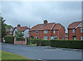
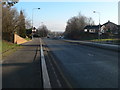
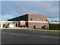
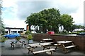
Photos of CW7 2WH
Area Information
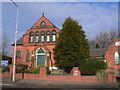
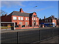
Living in CW7 2WH means inhabiting a tightly knit residential cluster in the heart of Winsford, a town with medieval roots and a population of around 35,500. The postcode area itself is small, spanning just 2.7 hectares, yet it holds 1,891 residents, translating to a population density of 71,049 people per square kilometre. This density reflects a compact, community-focused environment where daily life is shaped by proximity to local amenities and historical landmarks. Winsford sits on the River Weaver, historically a hub of trade and industry, and its modern character blends traditional architecture with contemporary needs. The town’s origins trace to the medieval townships of Over and Wharton, with St Chad’s Church, dating back over a thousand years, standing as a testament to its enduring heritage. Residents here benefit from a mix of local shops, rail links, and schools, all within practical reach, while the area’s small size fosters a sense of familiarity and connection. For those seeking a quiet, historically rich town with modern conveniences, CW7 2WH offers a distinctive blend of past and present.
- Area Type
- Postcode
- Area Size
- 2.7 hectares
- Population
- Not available
- Population Density
- Not available
The property market in CW7 2WH is characterised by a 52% home ownership rate, with houses forming the predominant accommodation type. This suggests a market skewed towards owner-occupied properties, though the remaining 48% likely includes rental units, though specific data on rentals is absent. Given the area’s small size—just 2.7 hectares—the housing stock is limited, which may lead to competition among buyers. The concentration of houses implies a focus on family homes, potentially appealing to those seeking private, spacious living. However, the high population density (71,049 people per square kilometre) raises questions about the availability of larger properties or land. For buyers, this small postcode area offers a compact, community-oriented environment, but its immediate surroundings may hold more options. Prospective buyers should consider the limited spatial footprint and the potential for a tight local market, particularly for properties with specific characteristics.
House Prices in CW7 2WH
Showing 40 properties
| Address | Type | Beds | Baths | Last Sale Price | Last Sale Date | |
|---|---|---|---|---|---|---|
| Tennis 118M From 27 Oakes Close 21M From Unnamed Road, Alexandra Street, Winsford, CW7 2WH | Leisure | - | - | - | - | |
| 4 Oakes Close, Winsford, CW7 2WH | house | - | - | - | - | |
| 1 Oakes Close, Winsford, CW7 2WH | house | - | - | - | - | |
| 19 Oakes Close, Winsford, CW7 2WH | house | - | - | - | - | |
| 24 Oakes Close, Winsford, CW7 2WH | house | - | - | - | - | |
| 22 Oakes Close, Winsford, CW7 2WH | house | - | - | - | - | |
| 16 Oakes Close, Winsford, CW7 2WH | house | - | - | - | - | |
| 36 Oakes Close, Winsford, CW7 2WH | Flat | - | - | - | - | |
| 17 Oakes Close, Winsford, CW7 2WH | house | - | - | - | - | |
| 10 Oakes Close, Winsford, CW7 2WH | Flat | - | - | - | - |
Energy Efficiency in CW7 2WH
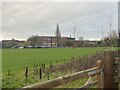
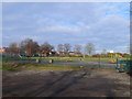
Life in CW7 2WH is enriched by nearby amenities that cater to everyday needs. Retail options include Aldi Dene, Farmfoods Winsford, and Asda Winsford, offering a range of grocery and household goods within walking distance. The area’s rail stations—Winsford, Hartford, and Greenbank—connect residents to broader networks, facilitating travel to work, leisure, or social events. While the data does not specify parks or leisure facilities, the town’s historical market, dating back to a 1280 charter, suggests a tradition of community gatherings and local commerce. The compact size of the postcode area means amenities are tightly clustered, promoting convenience. However, the absence of explicit details on parks or recreational spaces leaves some aspects of lifestyle unexplored. Nonetheless, the combination of retail access and rail connectivity ensures daily life remains practical and efficient for residents.
Amenities
Schools
Residents of CW7 2WH have access to three schools within practical reach. Winsford High Street Community Primary School is a primary school with a ‘good’ Ofsted rating, indicating a solid educational foundation for younger children. The Verdin High School is also a primary school, though its Ofsted rating is not specified in the data. The Winsford Academy, an academy school, holds a ‘satisfactory’ Ofsted rating, suggesting it meets basic standards but may have room for improvement. This mix of school types offers families a range of options, from traditional primary education to academies that may offer alternative curricula or specialisms. The presence of both primary schools and an academy reflects a diverse educational landscape, though the lack of detailed ratings for The Verdin High School leaves some uncertainty about its performance. Families prioritising high-quality education may need to investigate further, but the area’s proximity to these institutions is a clear advantage for parents.
| Rank | School | Type | Entry gender | Ages |
|---|
Explore more schools in this area
Go to Schools tabDemographics
The demographic profile of CW7 2WH is defined by a median age of 47, with the most common age range being adults aged 30–64. This suggests a mature, stable community where many residents are likely to be in their peak working or retirement years. Home ownership stands at 52%, indicating a mix of owner-occupied and rental properties, though the latter is not explicitly quantified. The predominant accommodation type is houses, which aligns with the area’s residential character and suggests a preference for single-family homes over flats or apartments. The predominant ethnic group is White, reflecting the broader demographic trends in the region. With a population density of 71,049 people per square kilometre, the area is highly compact, which may influence social dynamics and the availability of private space. This density, while indicative of a closely connected community, also underscores the need for efficient local services and infrastructure to meet residents’ needs.
Household Size
Accommodation Type
Tenure
Ethnic Group
Religion
Household Composition
Age
Household Deprivation
NS-SEC
Explore more demographic insights in this area
Go to Demographics tabPlanning
Planning Constraints
- Flood RiskPremium
- Ramsar Wetland SitesPremium
- Area of Outstanding Natural BeautyPremium
- Protected Nature ReservePremium
- Protected WoodlandPremium