Area Overview for CW7 2WE
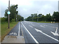
Photos of CW7 2WE

Area Information
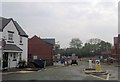
Living in CW7 2WE means being part of a tightly knit residential cluster in Cheshire, England. This small area spans 1.9 hectares and is home to 2,168 people, creating a densely populated yet compact community. The postcode falls within Winsford, a town with historical roots in medieval townships of Over and Wharton, now unified as a civil parish. Daily life here is shaped by proximity to key amenities, including five retail outlets like Morrisons Daily and Tesco Winsford, and five railway stations, including Winsford and Hartford, offering easy access to regional transport networks. The area’s population density of 1,425 people per square kilometre reflects a mix of long-standing residents and those drawn to its practicality. With a median age of 47 and a majority of adults aged 30–64, the community is mature and stable, with 82% of homes owned outright. This blend of historical charm and modern convenience makes CW7 2WE a distinct choice for those seeking a balanced lifestyle.
- Area Type
- Postcode
- Area Size
- 1.9 hectares
- Population
- 2168
- Population Density
- 1425 people/km²
The property market in CW7 2WE is characterised by high home ownership, with 82% of residents owning their homes outright. This contrasts with areas where rental markets dominate, suggesting a community focused on long-term investment rather than transient occupancy. The accommodation type is predominantly houses, reflecting a traditional, possibly older housing stock. Given the area’s small size—just 1.9 hectares—housing options are limited, likely concentrated in established residential clusters. For buyers, this means a focus on existing properties rather than new developments. The high home ownership rate also implies strong local demand, potentially limiting availability for new buyers. However, the presence of multiple railway stations nearby may appeal to those seeking easy access to regional transport networks. Prospective buyers should consider the area’s compact nature, which may restrict choices but also foster a cohesive, neighbourly atmosphere.
House Prices in CW7 2WE
Showing 51 properties
| Address | Type | Beds | Baths | Last Sale Price | Last Sale Date | |
|---|---|---|---|---|---|---|
| 7 Tighe Avenue, Winsford, CW7 2WE | Detached | 3 | 3 | £235,000 | Oct 2025 | |
| 31 Tighe Avenue, Winsford, CW7 2WE | house | - | - | £250,000 | Apr 2024 | |
| 23 Tighe Avenue, Winsford, CW7 2WE | house | - | - | £300,000 | Jun 2023 | |
| 65 Tighe Avenue, Winsford, CW7 2WE | house | - | - | £249,995 | Nov 2022 | |
| 45 Tighe Avenue, Winsford, CW7 2WE | house | - | - | £279,995 | Jul 2022 | |
| 47 Tighe Avenue, Winsford, CW7 2WE | Terraced | 3 | 1 | £175,842 | Jun 2022 | |
| 43 Tighe Avenue, Winsford, CW7 2WE | house | - | - | £234,995 | Jun 2022 | |
| 51 Tighe Avenue, Winsford, CW7 2WE | house | - | - | £189,995 | Jun 2022 | |
| 39 Tighe Avenue, Winsford, CW7 2WE | house | - | - | £245,995 | Jun 2022 | |
| 49 Tighe Avenue, Winsford, CW7 2WE | Detached | 3 | 1 | £189,995 | Jun 2022 |
Energy Efficiency in CW7 2WE
Residents of CW7 2WE have access to a range of amenities within easy reach, enhancing daily life. The area includes five retail outlets, such as Morrisons Daily and Spar, offering convenience for grocery shopping and everyday needs. Nearby railway stations, including Winsford and Cuddington, provide efficient transport links to surrounding areas, supporting both commuting and leisure travel. The town of Winsford itself has historical and cultural attractions, such as St Chad’s Church, which dates back over a thousand years, and a thriving market with roots in a 1280 charter. These elements contribute to a lifestyle that balances practicality with heritage. The proximity to retail and transport options, combined with the area’s compact nature, ensures that residents can access essentials without long commutes. This blend of modern convenience and historical character defines the lifestyle in CW7 2WE.
Amenities
Schools
| Rank | School | Type | Entry gender | Ages |
|---|
Explore more schools in this area
Go to Schools tabDemographics
The community in CW7 2WE is predominantly composed of adults aged 30–64, with a median age of 47. This suggests a mature population, likely with established careers and family ties. Home ownership is high, at 82%, indicating a strong preference for long-term residency over rental properties. The accommodation type is primarily houses, reflecting a traditional housing stock rather than flats or apartments. The predominant ethnic group is White, which aligns with broader demographic trends in the region. The population density of 1,425 people per square kilometre is notable for such a small area, implying a mix of single-family homes and shared spaces. While no specific deprivation data is provided, the high home ownership rate and stable age profile suggest a community with relatively low economic volatility. This demographic profile supports a quiet, settled environment, ideal for those prioritising stability over rapid change.
Household Size
Accommodation Type
Tenure
Ethnic Group
Religion
Household Composition
Age
Household Deprivation
NS-SEC
Explore more demographic insights in this area
Go to Demographics tabPlanning
Planning Constraints
- Flood RiskPremium
- Ramsar Wetland SitesPremium
- Area of Outstanding Natural BeautyPremium
- Protected Nature ReservePremium
- Protected WoodlandPremium