Area Overview for CW7 2SY
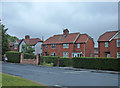
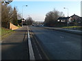
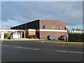
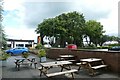
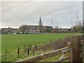
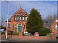
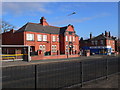
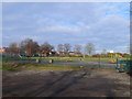
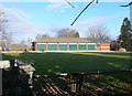
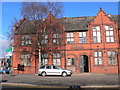
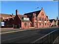
Photos of CW7 2SY

Area Information
Living in CW7 2SY means inhabiting a tightly packed residential cluster in the heart of Winsford, a historic town in Cheshire West and Chester. This postcode covers just 1.4 hectares, yet it is home to 1,891 people, translating to a population density of 135,951 per square kilometre — one of the highest in the UK. Winsford itself, with a population of around 35,500, is a town rooted in medieval history, with landmarks like St Chad’s Church and a market dating back to 1280. CW7 2SY lies within this compact, well-served town, where daily life is shaped by proximity to amenities, schools, and transport links. The area’s small size means residents are likely to know their neighbours, though the high density may limit private outdoor space. For those seeking a blend of historic character and modern convenience, CW7 2SY offers a snapshot of Winsford’s enduring charm and practicality.
- Area Type
- Postcode
- Area Size
- 1.4 hectares
- Population
- Not available
- Population Density
- Not available
The property market in CW7 2SY is defined by a 52% home ownership rate and a focus on houses, which are the predominant accommodation type. This suggests a mix of owner-occupied properties and rental units, though the exact proportion of rentals is not specified. The small area size — just 1.4 hectares — means the housing stock is limited, with properties likely concentrated in the immediate vicinity of Winsford’s core. For buyers, this presents both challenges and opportunities: the area’s proximity to schools, transport, and amenities may offset its compact footprint, but the scarcity of land could limit future development. Those considering homes here should evaluate the balance between property availability and the town’s established infrastructure, which includes retail, rail, and community facilities.
House Prices in CW7 2SY
Showing 31 properties
| Address | Type | Beds | Baths | Last Sale Price | Last Sale Date | |
|---|---|---|---|---|---|---|
| 25 Hawkshead Way, Winsford, CW7 2SY | Detached | 3 | 1 | £175,000 | Jan 2025 | |
| 39 Hawkshead Way, Winsford, CW7 2SY | Detached | 4 | 2 | £290,000 | Jan 2025 | |
| 3 Hawkshead Way, Winsford, CW7 2SY | Detached | 3 | 3 | £277,500 | Apr 2023 | |
| 57 Hawkshead Way, Winsford, CW7 2SY | Detached | 4 | 2 | £305,000 | Feb 2023 | |
| 61 Hawkshead Way, Winsford, CW7 2SY | house | - | - | £300,000 | Jul 2022 | |
| 15 Hawkshead Way, Winsford, CW7 2SY | house | - | - | £292,500 | Jul 2022 | |
| 49 Hawkshead Way, Winsford, CW7 2SY | Detached | - | - | £250,000 | Apr 2022 | |
| 5 Hawkshead Way, Winsford, CW7 2SY | house | 4 | 1 | £270,000 | Mar 2022 | |
| 45 Hawkshead Way, Winsford, CW7 2SY | Detached | 4 | - | £185,000 | Sep 2013 | |
| 27 Hawkshead Way, Winsford, CW7 2SY | house | 4 | - | £175,000 | Oct 2012 |
Energy Efficiency in CW7 2SY
The lifestyle in CW7 2SY is shaped by its proximity to retail and transport hubs. Within practical reach are five retail outlets, including Aldi Dene, Farmfoods Winsford, and Asda Winsford, offering a range of shopping options for daily needs. The area’s rail network, with five stations such as Winsford and Greenbank, connects residents to broader regional services and leisure opportunities. While the data does not specify parks or leisure facilities, the town’s historic market and surrounding areas suggest a blend of traditional and modern amenities. The convenience of nearby shops and transport links supports a practical, community-focused lifestyle, ideal for those prioritising accessibility over expansive green spaces.
Amenities
Schools
Residents of CW7 2SY have access to three schools within practical reach. Winsford High Street Community Primary School, a primary school with a good Ofsted rating, serves younger children, while The Verdin High School is also a primary school, though its rating is not specified. The Winsford Academy, an academy with a satisfactory Ofsted rating, offers secondary education. This mix of primary and secondary options provides families with a range of choices, though the academy’s rating suggests room for improvement. The presence of multiple schools within the area underscores Winsford’s focus on education, with the primary schools likely catering to the local population’s needs. For families prioritising school quality, the good rating at Winsford High Street Community Primary School is a notable advantage.
| Rank | School | Type | Entry gender | Ages |
|---|
Explore more schools in this area
Go to Schools tabDemographics
The community in CW7 2SY is predominantly middle-aged, with a median age of 47 and the most common age range being adults aged 30–64. Home ownership here stands at 52%, slightly below the national average, suggesting a mix of owner-occupied and rental properties. The accommodation type is primarily houses, reflecting a residential character distinct from high-density flats. The predominant ethnic group is White, though the data does not specify further diversity metrics. With 1,891 residents in a 1.4-hectare area, the population density is exceptionally high — over 135,000 people per square kilometre — which may impact the availability of communal spaces. This demographic profile indicates a stable, settled community, likely centred around family homes and local services.
Household Size
Accommodation Type
Tenure
Ethnic Group
Religion
Household Composition
Age
Household Deprivation
NS-SEC
Explore more demographic insights in this area
Go to Demographics tabPlanning
Planning Constraints
- Flood RiskPremium
- Ramsar Wetland SitesPremium
- Area of Outstanding Natural BeautyPremium
- Protected Nature ReservePremium
- Protected WoodlandPremium