Area Overview for CW7 2SH
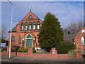
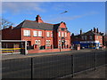
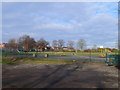
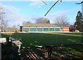
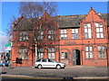
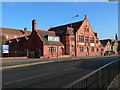
Photos of CW7 2SH


Area Information
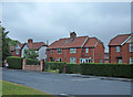
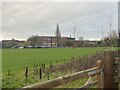
Living in CW7 2SH means being part of a small, tightly knit residential cluster in Cheshire, England. The area spans 1,380 square metres and is home to 1,333 residents, giving it a population density of 358 people per square kilometre. This compact postcode is part of Winsford, a historic town with roots in medieval townships of Over and Wharton. The town’s market, dating back to a 1280 charter, still thrives today, adding a sense of continuity to daily life. CW7 2SH is characterised by its low population density, which suggests a mix of single-family homes and a quieter, more suburban atmosphere. The area’s proximity to the River Weaver and its historical landmarks, such as St Chad’s Church, reflect a balance between modern convenience and heritage. Residents here benefit from nearby rail connections and a range of local amenities, making it a practical choice for those seeking a blend of tradition and accessibility. The low crime risk and absence of environmental constraints further enhance its appeal as a stable, family-friendly neighbourhood.
- Area Type
- Postcode
- Area Size
- 1380 m²
- Population
- 1333
- Population Density
- 358 people/km²
The property market in CW7 2SH is dominated by owner-occupied homes, with 82% of properties owned by residents rather than rented. This high home ownership rate suggests a stable, long-term community with little turnover, which can be attractive to buyers seeking a sense of permanence. The accommodation type is primarily houses, which is typical for areas with low population density and a suburban layout. This means the housing stock is likely to include larger properties with gardens, appealing to families or those prioritising space. Given the small size of the postcode area, the immediate surroundings may offer limited options, making it important for buyers to consider nearby towns like Winsford for additional choices. The market’s focus on owner-occupied homes also implies lower rental demand, which could influence property values and availability.
House Prices in CW7 2SH
Showing 5 properties
| Address | Type | Beds | Baths | Last Sale Price | Last Sale Date | |
|---|---|---|---|---|---|---|
| 3 Staveley Drive, Winsford, CW7 2SH | house | 1 | 1 | £117,500 | Oct 2022 | |
| 2 Staveley Drive, Winsford, CW7 2SH | Semi-detached | 2 | 1 | £180,000 | Nov 2015 | |
| 5 Staveley Drive, Winsford, CW7 2SH | Semi-detached | 2 | 1 | £100,500 | Apr 2015 | |
| 1 Staveley Drive, Winsford, CW7 2SH | Semi-detached | - | - | £34,000 | Jun 1996 | |
| Development At, Staveley Drive, Winsford, CW7 2SH | undefined | - | - | - | - |
Energy Efficiency in CW7 2SH
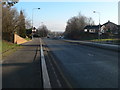
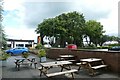
Life in CW7 2SH is supported by a range of nearby amenities within practical reach. Retail options include Aldi Dene, Farmfoods Winsford, and Asda Winsford, offering everyday shopping convenience. The area’s rail links, such as Winsford Railway Station, provide easy access to broader networks, enhancing mobility for work, travel, or socialising. While the postcode itself is small, the larger town of Winsford offers additional facilities, including its historic market, which continues to operate today. The presence of St Chad’s Church and other historical landmarks adds cultural depth to daily life. The low population density and suburban layout suggest a quieter, more relaxed lifestyle, with opportunities for outdoor activities near the River Weaver. These amenities and features combine to create a balanced environment that prioritises both practicality and heritage.
Amenities
Schools
| Rank | School | Type | Entry gender | Ages |
|---|
Explore more schools in this area
Go to Schools tabDemographics
The community in CW7 2SH is predominantly middle-aged, with a median age of 47 and the most common age range being adults aged 30–64. This suggests a mature, established population, likely with strong ties to the local area. Home ownership is high, at 82%, indicating a stable housing market and a focus on long-term residency. The accommodation type is primarily houses, which aligns with the area’s low population density and suburban character. The predominant ethnic group is White, reflecting the broader demographic trends in Cheshire. While no specific data on deprivation is provided, the high home ownership rate and age profile suggest a community with relatively stable economic conditions. The absence of significant diversity data means the area’s social fabric is largely homogenous, which may influence the pace of change and community dynamics.
Household Size
Accommodation Type
Tenure
Ethnic Group
Religion
Household Composition
Age
Household Deprivation
NS-SEC
Explore more demographic insights in this area
Go to Demographics tabPlanning
Planning Constraints
- Flood RiskPremium
- Ramsar Wetland SitesPremium
- Area of Outstanding Natural BeautyPremium
- Protected Nature ReservePremium
- Protected WoodlandPremium