Area Overview for CW7 2LY
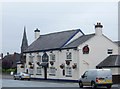
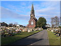
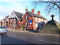
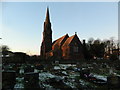
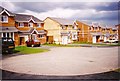
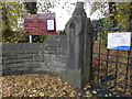
Photos of CW7 2LY
Area Information
Living in CW7 2LY means being part of a tightly knit residential cluster in the heart of Winsford, a town with medieval roots and a population of around 35,500. This postcode area covers just 1.5 hectares, housing 1,750 people in a densely populated setting. Winsford’s history is etched into its landscape, from St Chad’s Church—dating back over a millennium—to the River Weaver, which has shaped the town’s identity for centuries. Daily life here is grounded in tradition and convenience, with access to a mix of primary schools, including the Ofsted-rated good The Oak View Academy, and nearby railway stations like Winsford and Hartford. The area’s compact size means amenities are within practical reach, while its historical charm persists in landmarks like the 1543 preaching cross. For those seeking a blend of heritage and modernity, CW7 2LY offers a distinct slice of Cheshire life, where small-town character meets accessible infrastructure.
- Area Type
- Postcode
- Area Size
- 1.5 hectares
- Population
- 1750
- Population Density
- 4351 people/km²
The property market in CW7 2LY is dominated by owner-occupied homes, with 63% of properties in private hands. The accommodation type is primarily houses, which is typical for a small, residential postcode area. This suggests a market skewed towards family homes rather than rental properties, though the limited area size means housing stock is constrained. Buyers should consider the compact nature of the area, which may limit availability and increase competition for properties. The high population density—over 100,000 people per square kilometre—means demand for housing is likely strong, particularly for homes near key amenities like schools and transport links. For those seeking a home in CW7 2LY, the focus on owner-occupation and traditional housing styles indicates a market that prioritises stability and long-term residency over short-term investment.
House Prices in CW7 2LY
Showing 40 properties
| Address | Type | Beds | Baths | Last Sale Price | Last Sale Date | |
|---|---|---|---|---|---|---|
| 167 Delamere Street, Winsford, CW7 2LY | Terraced | 2 | 1 | £130,000 | Apr 2025 | |
| 181 Delamere Street, Winsford, CW7 2LY | Semi-detached | 4 | 2 | £325,000 | Jan 2025 | |
| 159 Delamere Street, Winsford, CW7 2LY | house | 2 | 1 | £50,000 | Sep 2021 | |
| 177-179 Delamere Street, Winsford, CW7 2LY | Terraced | 4 | 1 | £142,000 | Jan 2015 | |
| 128 Delamere Street, Winsford, CW7 2LY | Cottage | 1 | - | £50,000 | Mar 2011 | |
| 169 Delamere Street, Winsford, CW7 2LY | house | - | - | £74,000 | Oct 2007 | |
| 126 Delamere Street, Winsford, CW7 2LY | house | 1 | 1 | £69,500 | Feb 2007 | |
| 122 Delamere Street, Winsford, CW7 2LY | house | - | - | £100,000 | Mar 2005 | |
| 124 Delamere Street, Winsford, CW7 2LY | Terraced | 2 | 1 | £47,000 | Nov 2003 | |
| Flat, 161 Delamere Street, Winsford, CW7 2LY | Flat | 1 | 1 | £57,500 | Nov 2002 |
Energy Efficiency in CW7 2LY
The lifestyle in CW7 2LY is shaped by its proximity to essential amenities, including five retail outlets like Tesco Winsford and Morrisons Daily, which provide groceries and everyday conveniences. The area’s railway stations—Winsford, Hartford, and Cuddington—offer easy access to broader regional networks, facilitating both daily commutes and weekend travel. While the postcode’s small size means parks and leisure facilities are not explicitly detailed in the data, the surrounding town of Winsford likely offers historical sites like St Chad’s Church and the River Weaver for recreation. The blend of retail, transport, and historical context creates a practical yet characterful environment, where residents can enjoy both modern convenience and a connection to local heritage.
Amenities
Schools
Residents of CW7 2LY have access to a range of primary schools, including Greenfields Primary School and Over St John’s CofE Primary School, both of which are Ofsted-rated good. The Oak View Academy, an academy school also rated good, provides secondary education options nearby. Additional primary schools include St Joseph’s Catholic Primary School and St Joseph’s Catholic Primary School, a Voluntary Academy. The mix of state and academy schools offers families a choice of educational environments, from traditional state-run institutions to academies with potentially distinct curricula. This diversity ensures that parents can select schools aligned with their preferences, whether prioritising faith-based education or broader academic opportunities. The proximity of multiple schools to the area underscores its appeal for families seeking reliable, high-quality education for their children.
| Rank | School | Type | Entry gender | Ages |
|---|
Explore more schools in this area
Go to Schools tabDemographics
The community in CW7 2LY is predominantly composed of adults aged 30–64, with a median age of 47. Home ownership stands at 63%, reflecting a mix of long-term residents and families. The area is characterised by houses rather than flats, aligning with its residential cluster profile. The predominant ethnic group is White, with no specific data on other demographics. The high population density—113,812 people per square kilometre—suggests a compact, possibly multi-generational living environment. While this density may influence local services and space availability, it also fosters a close-knit community. The age profile indicates a stable population with a focus on family-oriented living, supported by nearby primary schools and accessible transport links. This demographic structure shapes a neighbourhood where established residents coexist with newer arrivals, creating a balanced but cohesive social fabric.
Household Size
Accommodation Type
Tenure
Ethnic Group
Religion
Household Composition
Age
Household Deprivation
NS-SEC
Explore more demographic insights in this area
Go to Demographics tabPlanning
Planning Constraints
- Flood RiskPremium
- Ramsar Wetland SitesPremium
- Area of Outstanding Natural BeautyPremium
- Protected Nature ReservePremium
- Protected WoodlandPremium