Area Overview for CW7 2JX
Photos of CW7 2JX


Area Information
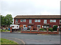
CW7 2JX is a compact postcode area in Winsford, Cheshire, encompassing a small residential cluster with a population of 2033 people. Despite its modest size of 2110 m², the area is densely populated, with 963,318 residents per square kilometre. Winsford itself is a historic town with roots in medieval townships of Over and Wharton, and this postcode area lies within its broader civil parish. Daily life here is shaped by its proximity to the River Weaver and its integration with nearby towns like Northwich and Middlewich. The area is served by multiple primary schools, including Mount Pleasant County Infant and Junior Schools, and is within reach of retail outlets like Tesco Winsford and Morrisons Daily. While the population density is high, the area’s character is defined by its mix of historic and modern infrastructure, with a focus on practical living for families and commuters.
- Area Type
- Postcode
- Area Size
- 2110 m²
- Population
- 2033
- Population Density
- 4417 people/km²
The property market in CW7 2JX is characterised by a low home ownership rate of 39%, suggesting that a significant portion of the housing stock is rented. The predominant accommodation type is houses, which may indicate a mix of semi-detached or terraced properties typical of smaller towns. Given the area’s small size and high population density, the housing stock is likely limited, with limited scope for expansion. For buyers, this means competition may be fierce, and properties are likely to be in high demand, particularly for families seeking proximity to schools and amenities. The rental market’s dominance also implies that landlords may hold a strong presence, influencing both prices and availability. Prospective buyers should consider the area’s compact nature and its integration with nearby towns for broader property options.
House Prices in CW7 2JX
Showing 4 properties
| Address | Type | Beds | Baths | Last Sale Price | Last Sale Date | |
|---|---|---|---|---|---|---|
| 2 Oakhouse Lane, Winsford, CW7 2JX | Semi-detached | 3 | 2 | £205,000 | Nov 2023 | |
| 6 Oakhouse Lane, Winsford, CW7 2JX | Terraced | 2 | - | £112,000 | Aug 2021 | |
| 4 Oakhouse Lane, Winsford, CW7 2JX | house | - | - | £64,500 | Sep 2003 | |
| 8 Oakhouse Lane, Winsford, CW7 2JX | Terraced | - | - | - | - |
Energy Efficiency in CW7 2JX
The lifestyle in CW7 2JX is shaped by its proximity to retail outlets such as Spar, Tesco Winsford, and Morrisons Daily, ensuring everyday shopping needs are met locally. The area’s historical roots are evident in landmarks like St Chad’s Church, though modern life is balanced with practical amenities. Residents can access rail services at nearby stations, enabling travel to surrounding towns. While the data does not specify parks or leisure facilities, the town’s market heritage and compact layout suggest a community-oriented environment. The availability of multiple schools and retail options enhances convenience, making daily life in the area both functional and connected to broader regional networks.
Amenities
Schools
Residents of CW7 2JX have access to several primary schools, including Over Hall Community School, Handley Hill Primary School, Mount Pleasant County Infant School, Mount Pleasant County Junior School, and the special needs-focused Oaklands School. These institutions cater to a range of educational needs, from standard primary education to specialist provisions. The presence of multiple primary schools within close proximity suggests a strong local focus on early education, which is beneficial for families. However, no secondary schools are listed in the data, so parents may need to consider commuting to nearby towns for further education. The variety of school types ensures that children with different learning requirements can find appropriate support within the area.
| Rank | School | Type | Entry gender | Ages |
|---|
Explore more schools in this area
Go to Schools tabDemographics
The median age in CW7 2JX is 47, with the majority of residents aged 30–64. This suggests a community skewed towards middle-aged adults, likely with established careers and families. Home ownership here is relatively low at 39%, indicating a rental market that may cater to professionals or those prioritising flexibility. The predominant accommodation type is houses, which aligns with the area’s residential cluster model. The predominant ethnic group is White, though specific data on diversity or deprivation is not provided. The high population density—nearly a million people per square kilometre—suggests compact living arrangements, which may influence local amenities and community dynamics. This demographic profile paints a picture of a stable, mature population with a focus on practical housing solutions.
Household Size
Accommodation Type
Tenure
Ethnic Group
Religion
Household Composition
Age
Household Deprivation
NS-SEC
Explore more demographic insights in this area
Go to Demographics tabPlanning
Planning Constraints
- Flood RiskPremium
- Ramsar Wetland SitesPremium
- Area of Outstanding Natural BeautyPremium
- Protected Nature ReservePremium
- Protected WoodlandPremium