Area Overview for CW7 2HZ
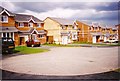
Photos of CW7 2HZ

Area Information
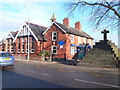
Living in CW7 2HZ means being part of a tightly knit residential cluster in the heart of Winsford, a historic town in Cheshire West and Chester. This postcode area covers 3,510 square metres and is home to 1,680 people, making it one of the most densely populated spaces in England. The area’s compact size reflects its character as a small, established community, with a population density of 478,649 people per square kilometre. Winsford itself, where CW7 2HZ is located, sits on the River Weaver and has roots in medieval townships of Over and Wharton, which merged in 1936. Daily life here is shaped by proximity to local amenities, including five retail outlets such as Morrisons Daily and Tesco Winsford, and five railway stations, including Winsford and Hartford, which connect residents to broader networks. The area’s blend of historical heritage and modern convenience makes it appealing to those seeking a balance between tradition and accessibility. With a median age of 47 and a strong presence of homeowners, CW7 2HZ offers a stable, community-focused environment for those prioritising security and local ties.
- Area Type
- Postcode
- Area Size
- 3510 m²
- Population
- 1680
- Population Density
- 1992 people/km²
The property market in CW7 2HZ is dominated by owner-occupied homes, with 64% of properties owned by residents rather than rented. This high homeownership rate indicates a community where long-term residency is common, often linked to the area’s historical and semi-rural character. The accommodation type is primarily houses, which contrasts with urban areas where flats or apartments predominate. This suggests a preference for larger, more private living spaces, likely catering to families or individuals seeking space and tranquillity. Given the area’s small size—just 3,510 square metres—the housing stock is limited, which may make the market competitive for buyers. Proximity to railway stations, such as Winsford and Hartford, adds appeal for commuters, while the absence of planning constraints like protected woodlands or nature reserves allows for more flexible development. For buyers, this means a focus on existing properties rather than new builds, with potential for character homes reflecting the area’s heritage.
House Prices in CW7 2HZ
Showing 10 properties
| Address | Type | Beds | Baths | Last Sale Price | Last Sale Date | |
|---|---|---|---|---|---|---|
| 127 Abbotts Way, Winsford, CW7 2HZ | house | 2 | 1 | £150,000 | Jul 2024 | |
| 129 Abbotts Way, Winsford, CW7 2HZ | Semi-detached | 3 | 1 | £173,000 | Oct 2023 | |
| 64 Abbotts Way, Winsford, CW7 2HZ | house | - | - | £115,000 | Jun 2022 | |
| 66 Abbotts Way, Winsford, CW7 2HZ | Semi-detached | 2 | 1 | £105,000 | Jan 2021 | |
| 131 Abbotts Way, Winsford, CW7 2HZ | house | - | - | £109,000 | Jun 2017 | |
| 68 Abbotts Way, Winsford, CW7 2HZ | Semi-detached | - | - | - | - | |
| 123 Abbotts Way, Winsford, CW7 2HZ | Semi-detached | - | - | - | - | |
| 125 Abbotts Way, Winsford, CW7 2HZ | Semi-detached | - | - | - | - | |
| 70 Abbotts Way, Winsford, CW7 2HZ | Semi-detached | - | - | - | - | |
| 121 Abbotts Way, Winsford, CW7 2HZ | house | - | - | - | - |
Energy Efficiency in CW7 2HZ
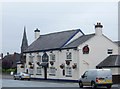
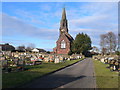
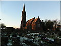
Residents of CW7 2HZ have access to a range of local amenities within practical reach, including five retail outlets such as Morrisons Daily, Tesco Winsford, and Spar, which provide essential shopping and convenience services. The area’s railway stations—Winsford, Hartford, and Cuddington—offer direct links to nearby towns, supporting both daily commutes and weekend excursions. While the data does not specify parks or leisure facilities, the historical context of Winsford suggests a town with cultural and heritage sites, such as St Chad’s Church and the medieval market, which continue to shape the local character. The presence of multiple retail options and transport links ensures a practical lifestyle, with minimal need to travel far for essentials. The compact nature of the area also fosters a sense of community, where local businesses and public spaces contribute to a familiar, accessible environment. For those valuing convenience and historical charm, CW7 2HZ offers a blend of modern amenities and traditional town life.
Amenities
Schools
| Rank | School | Type | Entry gender | Ages |
|---|
Explore more schools in this area
Go to Schools tabDemographics
The community in CW7 2HZ is predominantly composed of adults aged 30–64, reflecting a mature demographic with a median age of 47. Home ownership is high, at 64%, indicating a strong presence of long-term residents and a stable housing market. The area is characterised by houses rather than flats, which aligns with the preference for family-oriented or semi-detached properties. The predominant ethnic group is White, which is consistent with broader trends in the region. This demographic profile suggests a community with established roots and a focus on continuity. The high home ownership rate implies lower rental activity, which may contribute to a quieter, more settled atmosphere. However, the absence of specific data on deprivation or income levels means that broader economic factors influencing quality of life remain unquantified. The age range and ownership figures together suggest a population that values stability, with fewer young families or transient residents compared to other areas.
Household Size
Accommodation Type
Tenure
Ethnic Group
Religion
Household Composition
Age
Household Deprivation
NS-SEC
Explore more demographic insights in this area
Go to Demographics tabPlanning
Planning Constraints
- Flood RiskPremium
- Ramsar Wetland SitesPremium
- Area of Outstanding Natural BeautyPremium
- Protected Nature ReservePremium
- Protected WoodlandPremium