Area Overview for CW7 2EA
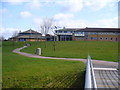
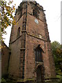
Photos of CW7 2EA


Area Information
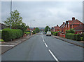
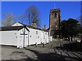
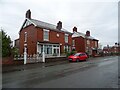
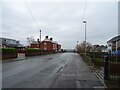
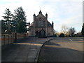
CW7 2EA is a small residential postcode area in Cheshire, England, covering just 1.4 hectares and home to 1,319 people. Despite its compact size, the area has a high population density of 95,833 people per square kilometre, reflecting its role as a tightly knit community. Located in Winsford, a historic town on the River Weaver, the area is part of a larger civil parish with a population of around 35,500. Winsford itself has medieval roots, with St Chad’s Church and a market charter dating back to the 13th century. Daily life here is shaped by its proximity to retail and transport hubs, including Spar, Tesco Winsford, and nearby railway stations. The area’s compact nature means residents are likely to know their neighbours, with a strong sense of local identity. While the population is predominantly White and skewed towards adults aged 30–64, the high home ownership rate of 73% suggests a stable, long-term resident base. Living in CW7 2EA offers a blend of historical charm and modern convenience, though its small size means the local landscape is defined by close-knit housing and limited green space.
- Area Type
- Postcode
- Area Size
- 1.4 hectares
- Population
- 1319
- Population Density
- 3632 people/km²
The property market in CW7 2EA is dominated by owner-occupied homes, with 73% of residents owning their properties. This suggests a market characterised by long-term occupancy rather than rental demand, which may limit opportunities for buyers seeking short-term investment. The accommodation type is primarily houses, which is typical for areas with higher home ownership rates and older demographics. Given the area’s small size—just 1.4 hectares—the housing stock is likely limited, with little scope for new developments. This could make the market competitive for buyers, particularly those seeking properties in the immediate vicinity. The high population density further underscores the scarcity of available land, meaning that properties here are likely to be well-established, with potential for characterful features reflecting the area’s historical roots. For buyers, this means a focus on existing homes rather than new builds, with the need to consider proximity to essential amenities like retail and transport hubs, which are within practical reach.
House Prices in CW7 2EA
Showing 23 properties
| Address | Type | Beds | Baths | Last Sale Price | Last Sale Date | |
|---|---|---|---|---|---|---|
| 566 High Street, Winsford, CW7 2EA | Terraced | 2 | 1 | £83,500 | Sep 2023 | |
| 574 High Street, Winsford, CW7 2EA | Terraced | 4 | 2 | £79,000 | Aug 2023 | |
| 512 High Street, Winsford, CW7 2EA | Terraced | 3 | 1 | £82,500 | May 2023 | |
| 568 High Street, Winsford, CW7 2EA | Terraced | 2 | - | £96,000 | Jan 2023 | |
| 562 High Street, Winsford, CW7 2EA | Terraced | 2 | 2 | £110,000 | Jul 2022 | |
| 502 High Street, Winsford, CW7 2EA | Terraced | 3 | 1 | £110,000 | Aug 2020 | |
| 560 High Street, Winsford, CW7 2EA | Terraced | 3 | 1 | £92,500 | Oct 2017 | |
| 516 High Street, Winsford, CW7 2EA | house | 3 | - | £99,000 | Jul 2016 | |
| 570 High Street, Winsford, CW7 2EA | Terraced | 2 | 1 | £58,000 | Jan 2015 | |
| 564 High Street, Winsford, CW7 2EA | Retail | 4 | 1 | £128,950 | Apr 2014 |
Energy Efficiency in CW7 2EA
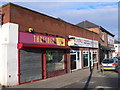
Living in CW7 2EA offers access to a range of practical amenities within walking or short driving distance. The area is served by five retail outlets, including Spar, Tesco Winsford, and Aldi Dene, providing everyday shopping convenience. These stores cater to a variety of needs, from groceries to household essentials, reducing the need for long trips to larger centres. The presence of five railway stations—Winsford, Hartford, and Greenbank—enhances mobility, connecting residents to nearby towns and cities. While the data does not mention parks or leisure facilities directly, the historical context of Winsford suggests a town with a market tradition and potential for local events. The compact nature of the area means that amenities are closely clustered, fostering a sense of convenience. However, the absence of specific data on parks or recreational spaces means that residents may need to look further afield for green space or leisure activities. Overall, the lifestyle in CW7 2EA is defined by accessibility to retail and transport, with a focus on practicality over expansive amenities.
Amenities
Schools
| Rank | School | Type | Entry gender | Ages |
|---|
Explore more schools in this area
Go to Schools tabDemographics
The community in CW7 2EA is predominantly composed of adults aged 30–64, with a median age of 47. This suggests a mature population, likely with established careers and families. Home ownership is high at 73%, indicating a strong presence of long-term residents rather than transient renters. The area is primarily composed of houses, which aligns with the demographic profile of older, family-oriented households. The predominant ethnic group is White, reflecting the broader demographic trends in the region. The population density of 95,833 people per square kilometre is exceptionally high, which may influence the character of daily life, fostering a tightly woven social fabric but potentially limiting private space. This density also means that amenities and services are likely to be closely clustered, with residents relying on nearby shops and transport links. The absence of specific data on deprivation or income levels means that quality of life considerations are inferred from the stability of home ownership and the age profile, which often correlates with lower turnover and community cohesion.
Household Size
Accommodation Type
Tenure
Ethnic Group
Religion
Household Composition
Age
Household Deprivation
NS-SEC
Explore more demographic insights in this area
Go to Demographics tabPlanning
Planning Constraints
- Flood RiskPremium
- Ramsar Wetland SitesPremium
- Area of Outstanding Natural BeautyPremium
- Protected Nature ReservePremium
- Protected WoodlandPremium