Area Overview for CW7 2DR
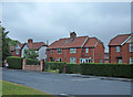
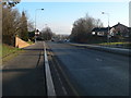
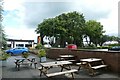
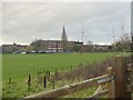
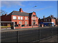
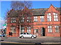
Photos of CW7 2DR


Area Information
CW7 2DR is a compact residential postcode in Cheshire, England, encompassing a small cluster of homes within the town of Winsford. With a population of 1,891 and an area of just 9,432 m², the postcode is densely populated, reflecting a tight-knit community. Winsford itself, where this area lies, has roots in medieval times, with historical ties to the River Weaver and the former townships of Over and Wharton. The town’s market, granted a charter in 1280, remains a focal point, and its modern infrastructure includes retail outlets and rail links. Living here means proximity to local amenities, a mix of historic and contemporary architecture, and a community shaped by its long-standing traditions. The high population density suggests a blend of long-term residents and those drawn to the area’s convenience, though the small size means the character of the area is immediately apparent to newcomers.
- Area Type
- Postcode
- Area Size
- 9432 m²
- Population
- Not available
- Population Density
- Not available
The property market in CW7 2DR is characterised by a 52% home ownership rate, with houses being the predominant accommodation type. This suggests a residential area where many residents are long-term homeowners, likely prioritising stability over investment. The small size of the postcode means the housing stock is limited, potentially leading to competition for available properties. Given the high population density, properties may be smaller or more closely spaced than in larger towns. For buyers, this area could appeal to those seeking a compact, community-oriented environment, though the lack of detailed data on property sizes or price ranges means further local research would be necessary. The mix of owner-occupied homes and rentals also hints at a balance between permanent residents and those seeking short-term housing solutions.
House Prices in CW7 2DR
Showing 36 properties
| Address | Type | Beds | Baths | Last Sale Price | Last Sale Date | |
|---|---|---|---|---|---|---|
| 10 Baywillow Close, Winsford, CW7 2DR | Flat | - | - | - | - | |
| 4 Baywillow Close, Winsford, CW7 2DR | Flat | - | - | - | - | |
| 8 Baywillow Close, Winsford, CW7 2DR | Flat | - | - | - | - | |
| 21 Baywillow Close, Winsford, CW7 2DR | house | - | - | - | - | |
| 3 Baywillow Close, Winsford, CW7 2DR | Flat | - | - | - | - | |
| 5 Baywillow Close, Winsford, CW7 2DR | Flat | - | - | - | - | |
| 24 Baywillow Close, Winsford, CW7 2DR | house | - | - | - | - | |
| 17 Baywillow Close, Winsford, CW7 2DR | Flat | - | - | - | - | |
| 11 Baywillow Close, Winsford, CW7 2DR | Flat | - | - | - | - | |
| 19 Baywillow Close, Winsford, CW7 2DR | Flat | - | - | - | - |
Energy Efficiency in CW7 2DR
The lifestyle in CW7 2DR is supported by a range of nearby amenities. Retail options include Aldi Dene, Asda Winsford, and Farmfoods Winsford, offering everyday shopping needs within easy reach. The rail network, with stations like Winsford and Hartford, connects residents to broader regional networks, facilitating travel for work, leisure, or social visits. While the data does not specify parks or leisure facilities, the proximity to Winsford’s historic market and its compact layout suggests a community-centred lifestyle. The availability of local shops and rail links means daily errands and travel are efficient, contributing to a practical, accessible way of life.
Amenities
Schools
Residents of CW7 2DR have access to three schools within practical reach. Winsford High Street Community Primary School is a primary school with a good Ofsted rating, offering a reliable educational foundation for younger children. The Verdin High School, also a primary school, is listed but lacks an Ofsted rating in the data. The Winsford Academy, an academy school, has a satisfactory Ofsted rating, indicating it meets basic standards but may have areas for improvement. The presence of both primary and academy schools provides families with options, though the lack of detailed ratings for one school means potential buyers should verify current performance independently. The mix of school types reflects a blend of traditional and more recently established educational institutions.
| Rank | School | Type | Entry gender | Ages |
|---|
Explore more schools in this area
Go to Schools tabDemographics
The population of CW7 2DR is predominantly adults aged 30–64, with a median age of 47. This suggests a mature, stable community with a strong presence of families and professionals. Home ownership stands at 52%, indicating a mix of owner-occupied properties and rental homes. The accommodation type is primarily houses, which aligns with the area’s residential character. The predominant ethnic group is White, reflecting broader trends in the region. The high population density of 200,484 people per km² implies a compact, closely packed living environment, which may influence the pace of daily life and access to shared resources. While the data does not specify deprivation levels, the density and age profile suggest a community focused on established living rather than rapid growth or demographic shifts.
Household Size
Accommodation Type
Tenure
Ethnic Group
Religion
Household Composition
Age
Household Deprivation
NS-SEC
Explore more demographic insights in this area
Go to Demographics tabPlanning
Planning Constraints
- Flood RiskPremium
- Ramsar Wetland SitesPremium
- Area of Outstanding Natural BeautyPremium
- Protected Nature ReservePremium
- Protected WoodlandPremium