Area Overview for CW7 1PW
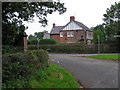
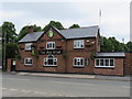
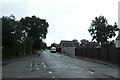
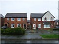
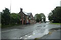
Photos of CW7 1PW
Area Information
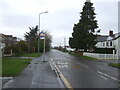
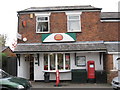
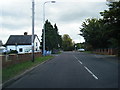
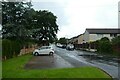
Living in CW7 1PW means being part of a tightly knit residential cluster in the heart of Winsford, Cheshire. This postcode area, covering 4,430 square metres, is home to 1,503 people, making it one of the most densely populated places in England, with 339,273 people per square kilometre. Winsford itself is a historic town with roots in medieval times, centred around the River Weaver and its market, which dates back to a 1280 charter. The area’s small size means residents are close to key amenities, including five retail outlets like Morrisons Daily and Asda Winsford, as well as five railway stations, including Winsford and Hartford. The community is predominantly adults aged 30–64, with a median age of 47, suggesting a stable, established population. While the area lacks natural constraints like protected woodlands or AONB designations, its compact nature means daily life is centred on local shops, transport links, and the town’s historical sites, such as St Chad’s Church. For those seeking a mix of convenience and tradition, CW7 1PW offers a distinct blend of residential living and accessible infrastructure.
- Area Type
- Postcode
- Area Size
- 4430 m²
- Population
- Not available
- Population Density
- Not available
The property market in CW7 1PW is shaped by its small size and high population density. With only 1,503 residents spread over 4,430 square metres, the area is characterised by a limited housing stock, primarily consisting of houses. This contrasts with typical urban areas where flats or apartments dominate, suggesting a focus on single-family dwellings. The 38% home ownership rate indicates that a majority of properties are rented, which may reflect the area’s appeal to tenants seeking stable, long-term housing. Given the compact nature of CW7 1PW, buyers looking to purchase in this postcode should consider the immediate surrounding areas for more options. The predominance of houses also implies that properties may be larger than average for the population size, potentially offering more space per household. However, the limited size of the area means competition for available properties could be intense, particularly for those prioritising proximity to local amenities and transport links.
House Prices in CW7 1PW
Showing 13 properties
| Address | Type | Beds | Baths | Last Sale Price | Last Sale Date | |
|---|---|---|---|---|---|---|
| 1 Stuart Close, Winsford, CW7 1PW | Bungalow | 2 | 1 | £215,000 | May 2023 | |
| 19 Stuart Close, Winsford, CW7 1PW | house | 1 | 1 | £97,000 | May 2022 | |
| 27 Stuart Close, Winsford, CW7 1PW | house | - | - | £100,000 | Mar 2022 | |
| 15 Stuart Close, Winsford, CW7 1PW | Terraced | 1 | 1 | £95,000 | Feb 2022 | |
| 11 Stuart Close, Winsford, CW7 1PW | house | - | - | £69,000 | Nov 2012 | |
| 23 Stuart Close, Winsford, CW7 1PW | house | 1 | 1 | £55,000 | Aug 2012 | |
| 3 Stuart Close, Winsford, CW7 1PW | Bungalow | 2 | - | £118,000 | Mar 2011 | |
| 21 Stuart Close, Winsford, CW7 1PW | Flat | - | - | £48,000 | Apr 2003 | |
| 17 Stuart Close, Winsford, CW7 1PW | Semi-detached | 1 | 1 | £26,250 | Oct 1998 | |
| 7 Stuart Close, Winsford, CW7 1PW | Flat | - | - | £34,000 | Apr 1995 |
Energy Efficiency in CW7 1PW
Life in CW7 1PW is centred around its compact network of amenities and historical character. Residents have access to five retail outlets, including Morrisons Daily and Asda Winsford, offering daily essentials and groceries within walking or short driving distance. The area’s rail links, with stations like Winsford and Hartford, provide easy access to broader regional services and employment opportunities. While the data does not mention parks or leisure facilities directly, the town of Winsford itself has historical landmarks, such as St Chad’s Church and the medieval market square, which contribute to a sense of heritage and community. The presence of nearby shops and transport options means daily errands and commutes are efficient, supporting a lifestyle that prioritises convenience without sacrificing the town’s traditional charm. The small postcode area’s density ensures that amenities are never far, though the lack of detailed information on green spaces or recreational facilities means those seeking outdoor activities may need to look beyond the immediate vicinity.
Amenities
Schools
| Rank | School | Type | Entry gender | Ages |
|---|
Explore more schools in this area
Go to Schools tabDemographics
The community in CW7 1PW is predominantly composed of adults aged 30–64, with a median age of 47. This suggests a mature population, likely with established careers and families. Home ownership here is relatively low at 38%, indicating that a significant portion of the housing stock is rented out, which may influence the local rental market dynamics. The area is characterised by houses as the primary accommodation type, which is unusual for a densely populated postcode, suggesting a mix of single-family homes and possibly larger properties. The predominant ethnic group is White, reflecting the broader demographic trends in Cheshire. The high population density of 339,273 people per square kilometre, while not directly linked to deprivation data, may impact living conditions, such as space per household or access to green areas. However, the absence of specific deprivation metrics means the quality of life is inferred from the availability of amenities and infrastructure, such as retail and rail links, which are well-served in this area.
Household Size
Accommodation Type
Tenure
Ethnic Group
Religion
Household Composition
Age
Household Deprivation
NS-SEC
Explore more demographic insights in this area
Go to Demographics tabPlanning
Planning Constraints
- Flood RiskPremium
- Ramsar Wetland SitesPremium
- Area of Outstanding Natural BeautyPremium
- Protected Nature ReservePremium
- Protected WoodlandPremium