Area Overview for CW7 1ND
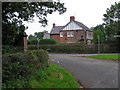
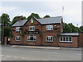
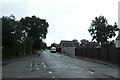
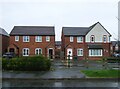
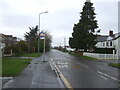
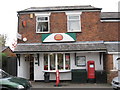
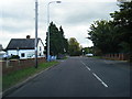
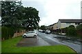
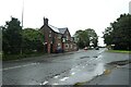
Photos of CW7 1ND
Area Information
Living in CW7 1ND means being part of a tightly knit residential cluster in Winsford, a town with a medieval heritage and a population of around 35,500. This postcode covers just 1.7 hectares, housing 1,503 residents in a densely packed area with a population density of 89,676 people per square kilometre. The compact nature of CW7 1ND reflects Winsford’s historical roots as a union of two medieval townships, Over and Wharton. Daily life here is shaped by proximity to local amenities, including five retail outlets like Morrisons and Spar, and easy access to rail links at Winsford, Hartford, and Cuddington stations. The area’s small size means residents are close to the town’s core, where landmarks like St Chad’s Church and the historic market square offer a sense of continuity with the past. While the community is small, it benefits from modern connectivity, with fixed broadband rated at 100/100. However, the high population density and limited space mean living in CW7 1ND requires adapting to a compact, efficient lifestyle.
- Area Type
- Postcode
- Area Size
- 1.7 hectares
- Population
- Not available
- Population Density
- Not available
The property market in CW7 1ND is defined by a 38% home ownership rate, with houses making up the majority of accommodation types. This suggests a mix of owner-occupied homes and rental properties, though the small area size means the housing stock is limited. Given the high population density, properties here are likely to be older, reflecting Winsford’s medieval origins and 19th-century development. Buyers should consider the compact nature of the area, as the 1.7-hectare postcode offers little scope for expansion. The predominance of houses over flats may appeal to those seeking traditional living, but the limited space could mean competition for available properties. For those looking to buy, the immediate surroundings may offer more options, though the data does not specify nearby areas. The low home ownership rate also hints at potential rental opportunities, though this could affect long-term investment stability.
House Prices in CW7 1ND
Showing 51 properties
| Address | Type | Beds | Baths | Last Sale Price | Last Sale Date | |
|---|---|---|---|---|---|---|
| 33 Leyland Walk, Winsford, CW7 1ND | Semi-detached | 4 | 2 | £125,000 | Jan 2025 | |
| 3 Leyland Walk, Winsford, CW7 1ND | Terraced | 3 | 2 | £106,500 | Oct 2021 | |
| 8 Leyland Walk, Winsford, CW7 1ND | Terraced | - | - | - | - | |
| 14 Leyland Walk, Winsford, CW7 1ND | Terraced | - | - | - | - | |
| 22 Leyland Walk, Winsford, CW7 1ND | house | - | - | - | - | |
| 20 Leyland Walk, Winsford, CW7 1ND | Terraced | - | - | - | - | |
| 18 Leyland Walk, Winsford, CW7 1ND | Terraced | - | - | - | - | |
| 13 Leyland Walk, Winsford, CW7 1ND | Terraced | - | - | - | - | |
| 40 Leyland Walk, Winsford, CW7 1ND | Terraced | - | - | - | - | |
| 17 Leyland Walk, Winsford, CW7 1ND | Terraced | - | - | - | - |
Energy Efficiency in CW7 1ND
Life in CW7 1ND revolves around its proximity to essential amenities. Within practical reach are five retail outlets, including Morrisons Daily, Spar, and Farmfoods Winsford, providing convenience for shopping and daily needs. The area’s rail network, with stations like Winsford and Hartford, offers easy access to nearby towns and transport hubs. While the data does not mention parks or leisure facilities, the town’s historic market, established in 1280, continues to operate, adding to the local character. Residents can enjoy the town’s heritage, such as St Chad’s Church and the 1543 preaching cross, which contribute to a distinct sense of place. The compact layout means amenities are walkable, though the lack of detailed information on leisure options suggests further exploration may be needed for those prioritising recreational spaces.
Amenities
Schools
| Rank | School | Type | Entry gender | Ages |
|---|
Explore more schools in this area
Go to Schools tabDemographics
The community in CW7 1ND is predominantly middle-aged, with a median age of 47 and the majority of residents falling within the 30–64 age range. Home ownership is relatively low at 38%, suggesting a significant proportion of the housing stock is rented out. The area is characterised by houses rather than flats or apartments, reflecting a traditional residential layout. The predominant ethnic group is White, though no specific data on diversity or deprivation is provided. The high population density—89,676 people per square kilometre—implies shared spaces and a tightly woven social fabric. For buyers, this means a focus on communal living and proximity to services. The age profile suggests a stable, established population, though the lack of younger residents may impact future growth. The 38% home ownership rate also indicates a rental market that could influence property values and availability.
Household Size
Accommodation Type
Tenure
Ethnic Group
Religion
Household Composition
Age
Household Deprivation
NS-SEC
Explore more demographic insights in this area
Go to Demographics tabPlanning
Planning Constraints
- Flood RiskPremium
- Ramsar Wetland SitesPremium
- Area of Outstanding Natural BeautyPremium
- Protected Nature ReservePremium
- Protected WoodlandPremium