Area Overview for CW6 9BF
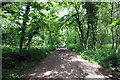
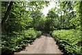
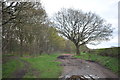
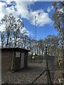
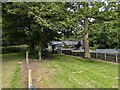
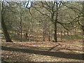
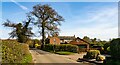
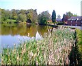
Photos of CW6 9BF
Area Information
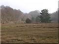
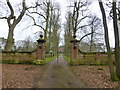
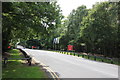
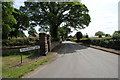
Living in CW6 9BF offers a defined sense of place within the Rushton civil parish of the Staffordshire Moorlands district. This specific postcode cluster covers an area of 5.0 hectares and holds a population of 1,471 residents. The location sits approximately 4 miles from Leek and 7 miles from Macclesfield, bordered to the north by the River Dane which separates it from Cheshire. Historically, the land is associated with Rushton Spencer and Rushton James, parishes that amalgamated in 1934. The village features the Grade II* listed Church of St Lawrence, a 17th-century rebuild on medieval foundations often described as the chapel in the wilderness, alongside a Methodist church built on Sugar Street in 1899. The local economy reflects the region's agricultural roots with a small legacy of coal, lime, and stone industries. You are entering a residential environment distinct from the bustling city centres nearby. The cluster functions as a small, contained community where the River Dane acts as a natural northern boundary. Life here revolves around the local parish identity and proximity to the A523 road, which links major destinations like Macclesfield and Leek. The setting provides a tranquil backdrop away from the industrial noise of the past, situated in an upland region characterized by open spaces and historical manor houses. This postcode represents a specific slice of rural life where residents benefit from proximity to two distinct market towns while maintaining a separate, quiet locality.
- Area Type
- Postcode
- Area Size
- 5.0 hectares
- Population
- 1471
- Population Density
- 38 people/km²
The property market in CW6 9BF is defined by a strong owner-occupier base. With 74% of residents owning their homes, the area functions primarily as a residential enclave for those looking to buy, rather than a rental hotspot. The accommodation stock is almost exclusively houses, meaning you will not find flats or urban-style apartment buildings within this 5.0-hectare perimeter. This housing typology suits families seeking gardens and private outdoor space, aligning with the village character of Rushton. Buyers interested in this postcode should expect a market driven by local moves and inheritance rather than large-scale development. The high ownership rate suggests that properties in the area have remained within local families for generations. If you are searching for homes in CW6 9BF, the inventory will reflect the historic nature of the parish, including traditional village houses near the Church of St Lawrence and properties along the A523 road. The small size of the rural cluster limits supply, which often sustains value for those priced right.
House Prices in CW6 9BF
Showing 5 properties
| Address | Type | Beds | Baths | Last Sale Price | Last Sale Date | |
|---|---|---|---|---|---|---|
| Oulton Mill House, Beech Lane, Rushton, Tarporley, CW6 9BF | Detached | 5 | 3 | - | - | |
| 3, Oulton Mill, Beech Lane, Rushton, Tarporley, CW6 9BF | Detached | 4 | - | - | - | |
| 2, Oulton Mill, Beech Lane, Rushton, Tarporley, CW6 9BF | house | 4 | - | - | - | |
| 1, Oulton Mill, Beech Lane, Rushton, Tarporley, CW6 9BF | Semi-detached | - | - | - | - | |
| 4, Oulton Mill, Beech Lane, Rushton, Tarporley, CW6 9BF | Detached | - | - | - | - |
Energy Efficiency in CW6 9BF
The lifestyle in CW6 9BF centres on the practical amenities within a short drive. Five local shops provide immediate necessities, including Budgens Tarporley, Co-op Tarporley, and Spar. These retail outlets are situated near Tarporley, allowing you to handle daily grocery shopping and convenience needs without travelling far. For residents seeking railway travel, Delamere, Cuddington, and Hartford stations are available nearby, offering five distinct rail access points to the wider network. The village character is anchored by the Grade II* listed Church of St Lawrence and a Methodist church on Sugar Street. These historic buildings serve as community focal points alongside the local amenities. You do not find typical high-street fashion or large leisure centres in this postcode, but the selection of supermarkets and local rail access compensates nicely for the rural setting. The presence of five retail and five rail options nearby ensures that while you are living in a quiet village, you are not cut off from essential services. This balance allows for a peaceful domestic life punctuated by quick trips for essentials or commuting.
Amenities
Schools
Families considering schools near CW6 9BF have Eaton Primary School as their nearest option. The school is located within the Rushton Spencer area and holds a Ofsted rating of 'good'. As the primary school is the only entry listed for this specific postcode cluster, it serves the local population well for early education needs. The 'good' rating indicates a school meeting a high standard of quality, ensuring that local children receive a curriculum that meets government expectations. While secondary education options lie further away, potentially in nearby Leek or Macclesfield, Eaton Primary provides a solid foundation for the 1,471 residents living in the parish. The lack of multiple primary options within the immediate 5.0-hectare boundary means families rely heavily on this single institution. This central focus supports strong community ties between the school, the village church, and the surrounding households, particularly given the village's small, close-knit nature.
| Rank | School | Type | Entry gender | Ages |
|---|
Explore more schools in this area
Go to Schools tabDemographics
The community in CW6 9BF skews towards mature age groups, with a median age of 47 years. The most numerous demographic consists of adults between 30 and 64 years old, indicating a stable population of established families and career professionals. Home ownership stands at a high rate of 74%, reflecting a neighbourhood where residents have put down roots rather than short-term tenants. The dominant accommodation type is houses, consistent with the area's status as a village within the Staffordshire Moorlands rather than a dense urban district. You will find a predominantly white ethnic composition within this residential cluster. The population density is low at 38 people per square kilometre, which reinforces the spacious, low-rise character of the area. With over three-quarters of residents owning their property, the social fabric is likely built on long-term connections rather than transient population shifts. This age profile suggests a community where life stages are stable; households are less likely to experience the frequent turnover common in student zones or retirement developments. The concentration of adults in their middle and older years supports local services that cater to families and those approaching retirement, creating a demographic environment focused on stability and ownership.
Household Size
Accommodation Type
Tenure
Ethnic Group
Religion
Household Composition
Age
Household Deprivation
NS-SEC
Explore more demographic insights in this area
Go to Demographics tabPlanning
Planning Constraints
- Flood RiskPremium
- Ramsar Wetland SitesPremium
- Area of Outstanding Natural BeautyPremium
- Protected Nature ReservePremium
- Protected WoodlandPremium