Area Overview for CW6 0QW
Photos of CW6 0QW


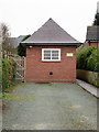
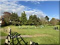
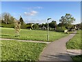

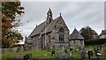
23 photos from this area
Area Information
Key information about the CW6 0QW including its size, population, and administrative classification.
- Area Type
- Postcode
- Area Size
- 3.7 hectares
- Population
- 2182
- Population Density
- 975 people/km²
House Prices in CW6 0QW
27
Properties
£355,103
Average Sold Price
£98,000
Lowest Price
£915,000
Highest Price
Showing 27 properties
| Address | Type | Beds | Baths | Last Sale Price | Last Sale Date | |
|---|---|---|---|---|---|---|
| 10 Duttons Lane, Kelsall, Chester, CW6 0QW | Detached | 3 | 2 | £395,000 | Sep 2024 | |
| Greenacres, 14 Duttons Lane, Kelsall, Chester, CW6 0QW | house | - | - | £915,000 | Sep 2023 | |
| 24 Duttons Lane, Kelsall, Chester, CW6 0QW | Bungalow | 4 | 2 | £520,000 | Dec 2022 | |
| Wildwinds, 21 Duttons Lane, Kelsall, Chester, CW6 0QW | Retail | 5 | 3 | £885,000 | Apr 2022 | |
| 5 Duttons Lane, Kelsall, Chester, CW6 0QW | Bungalow | 3 | - | £295,000 | Apr 2021 | |
| Streonshalh, 6 Duttons Lane, Kelsall, Chester, CW6 0QW | Semi-detached | 4 | 2 | £244,250 | Apr 2017 | |
| The Knowe, 16 Duttons Lane, Kelsall, Chester, CW6 0QW | Semi-detached | 4 | 2 | £302,500 | Jul 2014 | |
| Clanross, 25 Duttons Lane, Kelsall, Chester, CW6 0QW | house | - | - | £242,000 | Sep 2012 | |
| Westwinds, 19 Duttons Lane, Kelsall, Chester, CW6 0QW | Bungalow | - | - | £409,500 | Jan 2012 | |
| Stepping Stones, 15 Duttons Lane, Kelsall, Chester, CW6 0QW | Detached | - | - | £275,000 | Jul 2006 |
Page 1 of 3
Energy Efficiency in CW6 0QW
Amenities
Schools
| Rank | School | Type | Entry gender | Ages |
|---|
Explore more schools in this area
Go to Schools tabDemographics
Household Size
Two person
most common
Accommodation Type
Houses
most common
Tenure
91
majority
Ethnic Group
White
most common
Religion
N/A
most common
Household Composition
N/A
most common
Age
47
median
Adults (30-64 years)
most common
Household Deprivation
N/A
with no deprivation
NS-SEC
51
in Lower managerial occupations
Explore more demographic insights in this area
Go to Demographics tabPlanning
Planning Constraints
- Flood RiskPremium
- Ramsar Wetland SitesPremium
- Area of Outstanding Natural BeautyPremium
- Protected Nature ReservePremium
- Protected WoodlandPremium