Area Overview for CW5 8EL
Photos of CW5 8EL

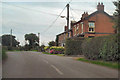
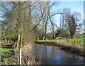
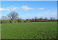


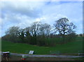

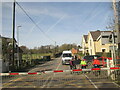
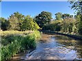
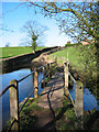
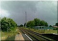
33 photos from this area
Area Information
Key information about the CW5 8EL including its size, population, and administrative classification.
- Area Type
- Postcode
- Area Size
- 40.8 hectares
- Population
- 2110
- Population Density
- 55 people/km²
House Prices in CW5 8EL
41
Properties
£269,227
Average Sold Price
£59,000
Lowest Price
£560,000
Highest Price
Showing 41 properties
| Address | Type | Beds | Baths | Last Sale Price | Last Sale Date | |
|---|---|---|---|---|---|---|
| The Nook, Nantwich Road, Wrenbury, CW5 8EL | Bungalow | 2 | 1 | £250,000 | Jan 2025 | |
| Springfields, Nantwich Road, Wrenbury, CW5 8EL | Retail | 3 | 1 | £337,500 | Sep 2022 | |
| 5, Oak Villas, Nantwich Road, Wrenbury, CW5 8EL | Semi-detached | - | - | £290,000 | Mar 2022 | |
| Oakdene, Nantwich Road, Wrenbury, CW5 8EL | Detached | 3 | 1 | £330,000 | Jun 2021 | |
| Oak Tree View, Nantwich Road, Wrenbury, CW5 8EL | house | - | - | £295,000 | May 2021 | |
| Fields Farm, Nantwich Road, Wrenbury, CW5 8EL | house | - | - | £560,000 | Sep 2016 | |
| 4, Oak Villas, Nantwich Road, Wrenbury, CW5 8EL | house | 2 | - | £185,000 | Nov 2014 | |
| Park View, Nantwich Road, Wrenbury, CW5 8EL | Detached | - | - | £240,000 | Jul 2007 | |
| Threeways, Nantwich Road, Wrenbury, CW5 8EL | Detached | - | - | £272,000 | May 2007 | |
| Oakfield Villa, Nantwich Road, Wrenbury, CW5 8EL | Detached | - | - | £312,500 | Oct 2006 |
Page 1 of 5
Energy Efficiency in CW5 8EL
Amenities
Schools
| Rank | School | Type | Entry gender | Ages |
|---|
Explore more schools in this area
Go to Schools tabDemographics
Household Size
Two person
most common
Accommodation Type
Houses
most common
Tenure
77
majority
Ethnic Group
White
most common
Religion
N/A
most common
Household Composition
N/A
most common
Age
47
median
Adults (30-64 years)
most common
Household Deprivation
N/A
with no deprivation
NS-SEC
39
in Lower managerial occupations
Explore more demographic insights in this area
Go to Demographics tabPlanning
Planning Constraints
- Flood RiskPremium
- Ramsar Wetland SitesPremium
- Area of Outstanding Natural BeautyPremium
- Protected Nature ReservePremium
- Protected WoodlandPremium