Area Overview for CW5 6RG
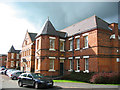
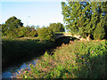
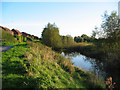
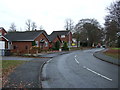
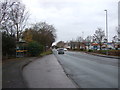
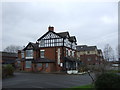
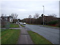
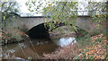
Photos of CW5 6RG

Area Information
Living in CW5 6RG means being part of a compact, residential cluster in Cheshire’s Nantwich area, a historic market town with roots in Roman salt production. The postcode covers 1,334 residents, with a dense population of 902 people per square kilometre, reflecting a tight-knit community. Nantwich itself, located at coordinates 53.068215, -2.521507, has long been a hub for industry and commerce, from medieval markets to its role in the English Civil War. Today, the area retains a mix of historic character and modern convenience. Residents benefit from proximity to three rail stations—Nantwich, Crewe, and Wrenbury—enabling easy access to nearby cities. The town’s heritage is visible in its timber-framed buildings and historic landmarks like St Mary’s Church. For families, the presence of Highfields Community Primary School and Highfields Academy offers educational options within walking distance. CW5 6RG is ideal for those seeking a balance of tradition and practicality, with a focus on home ownership and a community skewed toward adults aged 30–64.
- Area Type
- Postcode
- Area Size
- Not available
- Population
- 1334
- Population Density
- 902 people/km²
The property market in CW5 6RG is dominated by owner-occupied homes, with 82% of properties owned by residents rather than rented. This high home ownership rate suggests a stable market with limited rental availability, making it a desirable area for long-term buyers. The predominant accommodation type is houses, which is typical for smaller towns with low population density. This mix of home ownership and house-based housing stock indicates a community prioritising permanence over flexibility. For buyers, the small area size means competition for properties, but the focus on houses may appeal to those seeking family-friendly layouts. The lack of flats or apartments also aligns with the town’s historic character. Proximity to rail stations and schools adds to the area’s appeal, though the limited size of CW5 6RG means buyers must consider nearby towns for broader options.
House Prices in CW5 6RG
No properties found in this postcode.
Energy Efficiency in CW5 6RG
Residents of CW5 6RG enjoy a mix of retail, dining, and leisure options within Nantwich. The town’s retail scene includes Sainsburys, M&S, and Morrisons, providing essential shopping for groceries and daily needs. These stores are conveniently located, reducing the need for long trips to larger centres. The nearby rail stations also connect residents to broader networks, enhancing access to cultural and recreational facilities in surrounding towns. Nantwich’s historic character blends with modern amenities, offering a balance of heritage and practicality. The presence of timber-framed buildings and historic landmarks adds to the town’s charm, while the rail links ensure connectivity. For daily life, the combination of local shops and transport options supports a self-sufficient lifestyle, though residents may need to travel for specialist services.
Amenities
Schools
Residents of CW5 6RG have access to two schools within practical reach: Highfields Community Primary School, a primary institution, and Highfields Academy, an academy. Both are located in the nearby town of Nantwich, which is within walking or short driving distance for most residents. The presence of a primary school ensures early education is readily available, while the academy provides secondary-level schooling. The mix of school types offers families a range of educational options, though specific Ofsted ratings are not provided in the data. This combination of primary and academy schools suggests a well-rounded educational infrastructure, supporting families at different stages of their children’s schooling. The proximity of these schools to residential areas reinforces Nantwich’s appeal as a family-friendly town.
| Rank | School | Type | Entry gender | Ages |
|---|
Explore more schools in this area
Go to Schools tabDemographics
The population of CW5 6RG is 1,334, with a median age of 47 and a majority of residents aged 30–64. This suggests a mature, stable community with a strong presence of middle-aged adults. Home ownership is high at 82%, indicating a preference for long-term residency over rental properties. The area is predominantly White, with no data on other ethnic groups, though this may reflect local demographics rather than a lack of diversity. The accommodation type is primarily houses, which aligns with the high home ownership rate and the character of a small town. This profile suggests a community focused on stability and family life, with fewer transient residents. The absence of specific data on deprivation or income levels means the quality of life cannot be assessed in detail, but the high home ownership and age distribution point to a relatively secure, low-turnover environment.
Household Size
Accommodation Type
Tenure
Ethnic Group
Religion
Household Composition
Age
Household Deprivation
NS-SEC
Explore more demographic insights in this area
Go to Demographics tabPlanning
Planning Constraints
- Flood RiskPremium
- Ramsar Wetland SitesPremium
- Area of Outstanding Natural BeautyPremium
- Protected Nature ReservePremium
- Protected WoodlandPremium