Area Overview for CW5 6NU
Photos of CW5 6NU
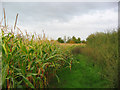
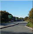
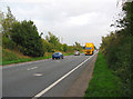
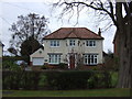


17 photos from this area
Area Information
Key information about the CW5 6NU including its size, population, and administrative classification.
- Area Type
- Postcode
- Area Size
- 62.3 hectares
- Population
- 1623
- Population Density
- 851 people/km²
House Prices in CW5 6NU
25
Properties
£356,628
Average Sold Price
£30,000
Lowest Price
£639,669
Highest Price
Showing 25 properties
| Address | Type | Beds | Baths | Last Sale Price | Last Sale Date | |
|---|---|---|---|---|---|---|
| The Paddocks, Colleys Lane, Willaston, CW5 6NU | Detached | 3 | 3 | £595,000 | Sep 2025 | |
| 140 Colleys Lane, Willaston, CW5 6NU | Detached | 7 | 3 | £639,669 | Feb 2023 | |
| 146 Colleys Lane, Willaston, CW5 6NU | Detached | 3 | 2 | £365,000 | Jul 2019 | |
| 128A Colleys Lane, Willaston, CW5 6NU | Detached | 4 | 2 | £480,000 | Mar 2018 | |
| 128 Colleys Lane, Willaston, CW5 6NU | house | 4 | - | £500,000 | Nov 2017 | |
| Ashfields, 155 Colleys Lane, Willaston, CW5 6NU | Detached | 5 | - | £30,000 | Jun 2016 | |
| 132 Colleys Lane, Willaston, CW5 6NU | house | - | - | £215,000 | Apr 2014 | |
| 156 Colleys Lane, Willaston, CW5 6NU | house | - | - | £284,000 | Oct 2013 | |
| 142 Colleys Lane, Willaston, CW5 6NU | house | - | - | £210,000 | Dec 2009 | |
| 215 Colleys Lane, Willaston, CW5 6NU | Detached | - | - | £545,000 | Feb 2007 |
Page 1 of 3
Energy Efficiency in CW5 6NU
Amenities
Schools
| Rank | School | Type | Entry gender | Ages |
|---|
Explore more schools in this area
Go to Schools tabDemographics
Household Size
Two person
most common
Accommodation Type
Houses
most common
Tenure
83
majority
Ethnic Group
White
most common
Religion
N/A
most common
Household Composition
N/A
most common
Age
47
median
Adults (30-64 years)
most common
Household Deprivation
N/A
with no deprivation
NS-SEC
45
in Lower managerial occupations
Explore more demographic insights in this area
Go to Demographics tabPlanning
Planning Constraints
- Flood RiskPremium
- Ramsar Wetland SitesPremium
- Area of Outstanding Natural BeautyPremium
- Protected Nature ReservePremium
- Protected WoodlandPremium