Area Overview for CW5 6LS
Photos of CW5 6LS

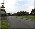
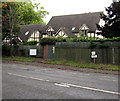
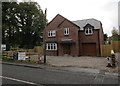
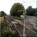
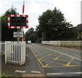
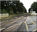
57 photos from this area
Area Information
Key information about the CW5 6LS including its size, population, and administrative classification.
- Area Type
- Postcode
- Area Size
- 8639 m²
- Population
- 1469
- Population Density
- 5248 people/km²
House Prices in CW5 6LS
13
Properties
£184,031
Average Sold Price
£131,500
Lowest Price
£275,000
Highest Price
Showing 13 properties
| Address | Type | Beds | Baths | Last Sale Price | Last Sale Date | |
|---|---|---|---|---|---|---|
| 7 Stapeley Terrace, Nantwich, CW5 6LS | Semi-detached | 2 | 1 | £165,000 | Sep 2023 | |
| 11 Stapeley Terrace, Nantwich, CW5 6LS | Bungalow | 2 | - | £167,000 | Oct 2021 | |
| 6 Stapeley Terrace, Nantwich, CW5 6LS | Bungalow | 2 | 1 | £270,000 | Jun 2021 | |
| 5A Stapeley Terrace, Nantwich, CW5 6LS | Detached | 3 | 1 | £275,000 | Jun 2021 | |
| 10 Stapeley Terrace, Nantwich, CW5 6LS | Bungalow | - | - | £165,000 | May 2018 | |
| 1 Stapeley Terrace, Nantwich, CW5 6LS | house | - | - | £165,000 | Dec 2014 | |
| 12 Stapeley Terrace, Nantwich, CW5 6LS | Semi-detached | 2 | - | £131,500 | Sep 2014 | |
| 5 Stapeley Terrace, Nantwich, CW5 6LS | Semi-detached | - | - | £133,750 | Aug 2005 | |
| 2 Stapeley Terrace, Nantwich, CW5 6LS | Semi-detached | - | - | - | - | |
| 3 Stapeley Terrace, Nantwich, CW5 6LS | Semi-detached | - | - | - | - |
Page 1 of 2
Energy Efficiency in CW5 6LS
Amenities
Schools
| Rank | School | Type | Entry gender | Ages |
|---|
Explore more schools in this area
Go to Schools tabDemographics
Household Size
One person
most common
Accommodation Type
Houses
most common
Tenure
61
majority
Ethnic Group
White
most common
Religion
N/A
most common
Household Composition
N/A
most common
Age
47
median
Adults (30-64 years)
most common
Household Deprivation
N/A
with no deprivation
NS-SEC
39
in Lower managerial occupations
Explore more demographic insights in this area
Go to Demographics tabPlanning
Planning Constraints
- Flood RiskPremium
- Ramsar Wetland SitesPremium
- Area of Outstanding Natural BeautyPremium
- Protected Nature ReservePremium
- Protected WoodlandPremium