Area Overview for CW5 6GF
Photos of CW5 6GF
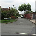
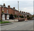
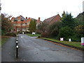
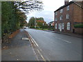
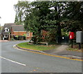
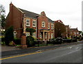
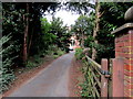
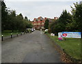
41 photos from this area
Area Information
Key information about the CW5 6GF including its size, population, and administrative classification.
- Area Type
- Postcode
- Area Size
- 5703 m²
- Population
- 1298
- Population Density
- 2268 people/km²
House Prices in CW5 6GF
12
Properties
£356,172
Average Sold Price
£93,500
Lowest Price
£430,000
Highest Price
Showing 12 properties
| Address | Type | Beds | Baths | Last Sale Price | Last Sale Date | |
|---|---|---|---|---|---|---|
| 4 Sandland Grove, Nantwich, CW5 6GF | Detached | 5 | 3 | £430,000 | Dec 2021 | |
| 7 Sandland Grove, Nantwich, CW5 6GF | Detached | 4 | 3 | £412,500 | Nov 2021 | |
| 1 Sandland Grove, Nantwich, CW5 6GF | Detached | 4 | 2 | £333,000 | Jun 2021 | |
| 6 Sandland Grove, Nantwich, CW5 6GF | Detached | 4 | 3 | £419,000 | Oct 2020 | |
| 12 Sandland Grove, Nantwich, CW5 6GF | Detached | 3 | 1 | £93,500 | Jun 2019 | |
| 2 Sandland Grove, Nantwich, CW5 6GF | Detached | 5 | 3 | £415,000 | Jan 2018 | |
| 5 Sandland Grove, Nantwich, CW5 6GF | Detached | 4 | 3 | £349,995 | Oct 2015 | |
| 9 Sandland Grove, Nantwich, CW5 6GF | Detached | 4 | 3 | £335,000 | Jun 2015 | |
| 10 Sandland Grove, Nantwich, CW5 6GF | house | - | - | £350,000 | Jun 2015 | |
| 8 Sandland Grove, Nantwich, CW5 6GF | house | - | - | £371,950 | Mar 2015 |
Page 1 of 2
Energy Efficiency in CW5 6GF
Amenities
Schools
| Rank | School | Type | Entry gender | Ages |
|---|
Explore more schools in this area
Go to Schools tabDemographics
Household Size
Two person
most common
Accommodation Type
Houses
most common
Tenure
94
majority
Ethnic Group
White
most common
Religion
N/A
most common
Household Composition
N/A
most common
Age
47
median
Elderly (65+ years)
most common
Household Deprivation
N/A
with no deprivation
NS-SEC
52
in Lower managerial occupations
Explore more demographic insights in this area
Go to Demographics tabPlanning
Planning Constraints
- Flood RiskPremium
- Ramsar Wetland SitesPremium
- Area of Outstanding Natural BeautyPremium
- Protected Nature ReservePremium
- Protected WoodlandPremium