Area Overview for CW5 6AU
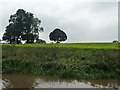
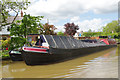
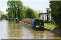
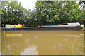
Photos of CW5 6AU
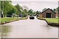

![Stoke Hall Bridge [No 99], Shropshire Union Canal in CW5 6AU](https://images.propbar.co.uk/images/geograph/52/11/5211939_120.jpg)

52 photos from this area
Area Information
Key information about the CW5 6AU including its size, population, and administrative classification.
- Area Type
- Postcode
- Area Size
- 26.8 hectares
- Population
- 1079
- Population Density
- 105 people/km²
House Prices in CW5 6AU
12
Properties
£418,333
Average Sold Price
£255,000
Lowest Price
£675,000
Highest Price
Showing 12 properties
| Address | Type | Beds | Baths | Last Sale Price | Last Sale Date | |
|---|---|---|---|---|---|---|
| Holly Tree Cottage, Mill Pool Lane, Barbridge, CW5 6AU | house | - | - | £675,000 | Jun 2021 | |
| Bunbury House, Mill Pool Lane, Barbridge, CW5 6AU | Detached | 5 | 3 | £325,000 | Dec 2006 | |
| Stoke Cottage, Mill Pool Lane, Barbridge, CW5 6AU | Detached | - | - | £255,000 | Dec 1996 | |
| 2, Mill Pool Cottages, Mill Pool Lane, Barbridge, CW5 6AU | Detached | 5 | 2 | - | - | |
| Chapel House, Mill Pool Lane, Barbridge, CW5 6AU | house | 5 | - | - | - | |
| Cholmondeley House, Mill Pool Lane, Barbridge, CW5 6AU | Detached | - | - | - | - | |
| Beeston House, Mill Pool Lane, Barbridge, CW5 6AU | Detached | - | - | - | - | |
| 3, Mill Pool Cottages, Mill Pool Lane, Barbridge, CW5 6AU | house | - | - | - | - | |
| Bulls Green Farm, Mill Pool Lane, Barbridge, CW5 6AU | house | - | - | - | - | |
| 1, Mill Pool Cottages, Mill Pool Lane, Barbridge, CW5 6AU | Semi-detached | 2 | - | - | - |
Page 1 of 2
Energy Efficiency in CW5 6AU
Amenities
Schools
| Rank | School | Type | Entry gender | Ages |
|---|
Explore more schools in this area
Go to Schools tabDemographics
Household Size
Two person
most common
Accommodation Type
Houses
most common
Tenure
74
majority
Ethnic Group
White
most common
Religion
N/A
most common
Household Composition
N/A
most common
Age
47
median
Adults (30-64 years)
most common
Household Deprivation
N/A
with no deprivation
NS-SEC
47
in Lower managerial occupations
Explore more demographic insights in this area
Go to Demographics tabPlanning
Planning Constraints
- Flood RiskPremium
- Ramsar Wetland SitesPremium
- Area of Outstanding Natural BeautyPremium
- Protected Nature ReservePremium
- Protected WoodlandPremium