Area Overview for CW5 5TE
Photos of CW5 5TE
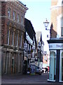
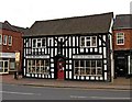
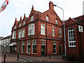
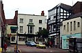
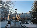
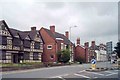
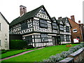
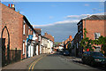
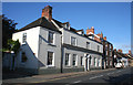
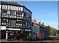
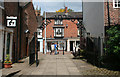
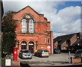
100 photos from this area
Area Information
Key information about the CW5 5TE including its size, population, and administrative classification.
- Area Type
- Postcode
- Area Size
- 1.4 hectares
- Population
- 1652
- Population Density
- 3180 people/km²
House Prices in CW5 5TE
17
Properties
£359,500
Average Sold Price
£120,000
Lowest Price
£822,000
Highest Price
Showing 17 properties
| Address | Type | Beds | Baths | Last Sale Price | Last Sale Date | |
|---|---|---|---|---|---|---|
| 31 Barker Street, Nantwich, CW5 5TE | Flat | - | - | £145,000 | Jun 2024 | |
| 20 Barker Street, Nantwich, CW5 5TE | house | - | - | £822,000 | Mar 2021 | |
| 37 Barker Street, Nantwich, CW5 5TE | Flat | - | - | £120,000 | Mar 2016 | |
| 34 Barker Street, Nantwich, CW5 5TE | Cottage | 3 | - | £351,000 | Jul 2014 | |
| FLAT 1C, 35 BARKER STREET, Nantwich, CW5 5TE | Flat | - | - | - | - | |
| 23 Love Lane, Nantwich, CW5 5TE | undefined | - | - | - | - | |
| 35 Barker Street, Nantwich, CW5 5TE | Flat | - | - | - | - | |
| 33 Barker Street, Nantwich, CW5 5TE | Flat | - | - | - | - | |
| 27 Barker Street, Nantwich, CW5 5TE | house | - | - | - | - | |
| Flat 1, 22A Barker Street, Nantwich, CW5 5TE | Flat | - | - | - | - |
Page 1 of 2
Energy Efficiency in CW5 5TE
Amenities
Schools
| Rank | School | Type | Entry gender | Ages |
|---|
Explore more schools in this area
Go to Schools tabDemographics
Household Size
One person
most common
Accommodation Type
Houses
most common
Tenure
62
majority
Ethnic Group
White
most common
Religion
N/A
most common
Household Composition
N/A
most common
Age
47
median
Adults (30-64 years)
most common
Household Deprivation
N/A
with no deprivation
NS-SEC
37
in Lower managerial occupations
Explore more demographic insights in this area
Go to Demographics tabPlanning
Planning Constraints
- Flood RiskPremium
- Ramsar Wetland SitesPremium
- Area of Outstanding Natural BeautyPremium
- Protected Nature ReservePremium
- Protected WoodlandPremium