Area Overview for CW4 8EL
Photos of CW4 8EL
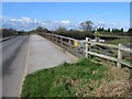
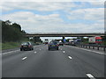
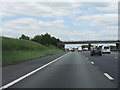
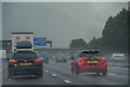


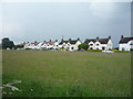
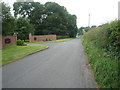
19 photos from this area
Area Information
Key information about the CW4 8EL including its size, population, and administrative classification.
- Area Type
- Postcode
- Area Size
- 42.7 hectares
- Population
- 2394
- Population Density
- 227 people/km²
House Prices in CW4 8EL
16
Properties
£259,958
Average Sold Price
£52,500
Lowest Price
£850,000
Highest Price
Showing 16 properties
| Address | Type | Beds | Baths | Last Sale Price | Last Sale Date | |
|---|---|---|---|---|---|---|
| 16 Byley Lane, Cranage, CW4 8EL | Semi-detached | 3 | 1 | £370,000 | Mar 2025 | |
| Parklands, Byley Lane, Cranage, CW4 8EL | Detached | 4 | 2 | £850,000 | Jun 2022 | |
| 20 Byley Lane, Cranage, CW4 8EL | house | 3 | - | £247,500 | Dec 2018 | |
| 22 Byley Lane, Cranage, CW4 8EL | Semi-detached | 3 | 1 | £185,000 | Dec 2017 | |
| 18 Byley Lane, Cranage, CW4 8EL | Cottage | 3 | - | £225,000 | Oct 2016 | |
| Keepers Cottage, Byley Lane, Cranage, CW4 8EL | Detached | - | - | £485,000 | Jul 2015 | |
| 10 Byley Lane, Cranage, CW4 8EL | Semi-detached | - | - | £174,500 | Jul 2006 | |
| 2 Byley Lane, Cranage, CW4 8EL | Semi-detached | - | - | £210,000 | Jul 2006 | |
| 12 Byley Lane, Cranage, CW4 8EL | Semi-detached | - | - | £182,000 | May 2006 | |
| 4 Byley Lane, Cranage, CW4 8EL | Semi-detached | - | - | £52,500 | Aug 2000 |
Page 1 of 2
Energy Efficiency in CW4 8EL
Amenities
Schools
| Rank | School | Type | Entry gender | Ages |
|---|
Explore more schools in this area
Go to Schools tabDemographics
Household Size
Two person
most common
Accommodation Type
Houses
most common
Tenure
91
majority
Ethnic Group
White
most common
Religion
N/A
most common
Household Composition
N/A
most common
Age
47
median
Adults (30-64 years)
most common
Household Deprivation
N/A
with no deprivation
NS-SEC
51
in Lower managerial occupations
Explore more demographic insights in this area
Go to Demographics tabPlanning
Planning Constraints
- Flood RiskPremium
- Ramsar Wetland SitesPremium
- Area of Outstanding Natural BeautyPremium
- Protected Nature ReservePremium
- Protected WoodlandPremium