Area Overview for CW4 7QG
Photos of CW4 7QG
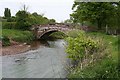
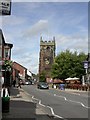
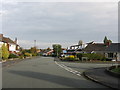
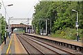
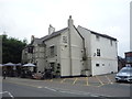
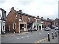

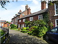
81 photos from this area
Area Information
Key information about the CW4 7QG including its size, population, and administrative classification.
- Area Type
- Postcode
- Area Size
- 1.9 hectares
- Population
- 1537
- Population Density
- 751 people/km²
House Prices in CW4 7QG
35
Properties
£260,603
Average Sold Price
£84,995
Lowest Price
£475,000
Highest Price
Showing 35 properties
| Address | Type | Beds | Baths | Last Sale Price | Last Sale Date | |
|---|---|---|---|---|---|---|
| 44 Elm Drive, Holmes Chapel, CW4 7QG | Detached | 4 | 2 | £440,000 | Jun 2024 | |
| 50 Elm Drive, Holmes Chapel, CW4 7QG | house | - | - | £380,000 | Nov 2021 | |
| 40 Elm Drive, Holmes Chapel, CW4 7QG | Detached | 4 | 2 | £473,000 | Aug 2021 | |
| 12 Elm Drive, Holmes Chapel, CW4 7QG | house | - | - | £475,000 | Mar 2021 | |
| 18 Elm Drive, Holmes Chapel, CW4 7QG | Detached | 3 | - | £315,500 | Feb 2021 | |
| 28 Elm Drive, Holmes Chapel, CW4 7QG | Detached | 3 | 2 | £285,000 | Apr 2018 | |
| 8 Elm Drive, Holmes Chapel, CW4 7QG | Detached | 4 | 2 | £412,000 | Oct 2017 | |
| 26 Elm Drive, Holmes Chapel, CW4 7QG | Detached | 3 | - | £281,000 | Aug 2017 | |
| 70 Elm Drive, Holmes Chapel, CW4 7QG | Detached | 4 | 2 | £340,000 | Jan 2016 | |
| 64 Elm Drive, Holmes Chapel, CW4 7QG | Detached | 4 | 5 | £413,000 | Sep 2015 |
Page 1 of 4
Energy Efficiency in CW4 7QG
Amenities
Schools
| Rank | School | Type | Entry gender | Ages |
|---|
Explore more schools in this area
Go to Schools tabDemographics
Household Size
Family (3-5 people)
most common
Accommodation Type
Houses
most common
Tenure
89
majority
Ethnic Group
White
most common
Religion
N/A
most common
Household Composition
N/A
most common
Age
47
median
Adults (30-64 years)
most common
Household Deprivation
N/A
with no deprivation
NS-SEC
51
in Lower managerial occupations
Explore more demographic insights in this area
Go to Demographics tabPlanning
Planning Constraints
- Flood RiskPremium
- Ramsar Wetland SitesPremium
- Area of Outstanding Natural BeautyPremium
- Protected Nature ReservePremium
- Protected WoodlandPremium