Area Overview for CW4 7JF
Photos of CW4 7JF
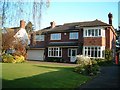
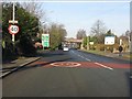
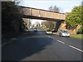
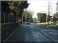

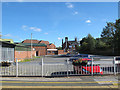
50 photos from this area
Area Information
Key information about the CW4 7JF including its size, population, and administrative classification.
- Area Type
- Postcode
- Area Size
- 2.1 hectares
- Population
- 1818
- Population Density
- 3174 people/km²
House Prices in CW4 7JF
35
Properties
£264,750
Average Sold Price
£85,000
Lowest Price
£387,500
Highest Price
Showing 35 properties
| Address | Type | Beds | Baths | Last Sale Price | Last Sale Date | |
|---|---|---|---|---|---|---|
| 96 Portree Drive, Holmes Chapel, CW4 7JF | Detached | 4 | - | £347,000 | Jul 2017 | |
| 74 Portree Drive, Holmes Chapel, CW4 7JF | Detached | 4 | - | £387,500 | Nov 2014 | |
| 90 Portree Drive, Holmes Chapel, CW4 7JF | Detached | 5 | - | £340,000 | Aug 2013 | |
| 101 Portree Drive, Holmes Chapel, CW4 7JF | Detached | - | - | £250,000 | Aug 2012 | |
| 87 Portree Drive, Holmes Chapel, CW4 7JF | house | 4 | - | £287,000 | Jan 2011 | |
| 78 Portree Drive, Holmes Chapel, CW4 7JF | Detached | - | - | £349,000 | Dec 2007 | |
| 82 Portree Drive, Holmes Chapel, CW4 7JF | Detached | - | - | £350,000 | Dec 2007 | |
| 107 Portree Drive, Holmes Chapel, CW4 7JF | Detached | - | - | £117,500 | Mar 2000 | |
| 75 Portree Drive, Holmes Chapel, CW4 7JF | Detached | - | - | £134,500 | May 1997 | |
| 103 Portree Drive, Holmes Chapel, CW4 7JF | Detached | 4 | 2 | £85,000 | Jul 1995 |
Page 1 of 4
Energy Efficiency in CW4 7JF
Amenities
Schools
| Rank | School | Type | Entry gender | Ages |
|---|
Explore more schools in this area
Go to Schools tabDemographics
Household Size
Family (3-5 people)
most common
Accommodation Type
Houses
most common
Tenure
86
majority
Ethnic Group
White
most common
Religion
N/A
most common
Household Composition
N/A
most common
Age
47
median
Adults (30-64 years)
most common
Household Deprivation
N/A
with no deprivation
NS-SEC
51
in Lower managerial occupations
Explore more demographic insights in this area
Go to Demographics tabPlanning
Planning Constraints
- Flood RiskPremium
- Ramsar Wetland SitesPremium
- Area of Outstanding Natural BeautyPremium
- Protected Nature ReservePremium
- Protected WoodlandPremium