Area Overview for CW3 0WB
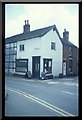
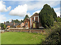
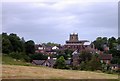
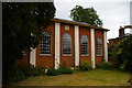
Photos of CW3 0WB
Area Information
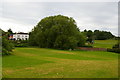
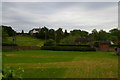
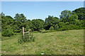
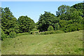
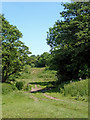
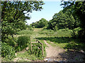
CW3 0WB is a small residential postcode cluster in Cheshire East, near the Shropshire border, encompassing the village of Audlem. With a population of 2,667 and a density of 64 people per square kilometre, it is a compact, low-density area characterised by traditional housing. The village has historical roots, including the 13th-century Church of St James the Great and the Shropshire Union Canal, which adds to its rural charm. Daily life here is shaped by its quiet, village atmosphere, with a median age of 47 and a majority of residents aged 30–64. The area is primarily owner-occupied, with 81% of homes owned by residents, suggesting a stable, long-term community. Proximity to Wrenbury and Nantwich railway stations provides access to nearby towns, while local shops like Co-op Shropshire and Morrisons Daily offer practical amenities. CW3 0WB balances historical character with modern convenience, making it appealing to those seeking a settled lifestyle in a low-risk, low-density setting.
- Area Type
- Postcode
- Area Size
- Not available
- Population
- 2667
- Population Density
- 64 people/km²
The property market in CW3 0WB is dominated by owner-occupied homes, with 81% of properties owned by residents rather than rented. This high home ownership rate suggests a stable, long-term community with little turnover. The predominant accommodation type is houses, which aligns with the area’s low-density, rural character. This housing stock is likely to include traditional family homes, reflecting the age profile of the population, which skews towards middle-aged and older adults. The small size of the area means that property choices are limited to the immediate cluster, with few new developments. Buyers should consider that the market is not driven by rental demand but by those seeking a permanent, settled home. The presence of nearby railway stations, such as Wrenbury and Nantwich, may also influence property values by providing access to larger towns.
House Prices in CW3 0WB
No properties found in this postcode.
Energy Efficiency in CW3 0WB
Living in CW3 0WB offers a mix of practical retail and historical character. The area has five retail outlets within practical reach, including Co-op Shropshire, Co-op Stapeley, and Morrisons Daily, ensuring everyday needs are met without long trips. The village’s historical sites, such as the 13th-century Church of St James the Great and the Shropshire Union Canal, add cultural depth to daily life. While there are no named parks or leisure facilities in the data, the low population density suggests ample open space. The presence of two railway stations, Wrenbury and Nantwich, enhances connectivity, allowing residents to access larger towns for dining, entertainment, or shopping. This blend of convenience and heritage creates a lifestyle that balances practicality with a touch of tradition, ideal for those seeking a settled, low-stress environment.
Amenities
Schools
| Rank | School | Type | Entry gender | Ages |
|---|
Explore more schools in this area
Go to Schools tabDemographics
The population of CW3 0WB is 2,667, with a median age of 47 and the majority of residents aged 30–64. This suggests a community of established adults, likely focused on family life or retirement. Home ownership is high at 81%, indicating a stable, long-term resident base rather than a transient rental market. The predominant accommodation type is houses, reflecting a traditional, low-density housing stock. The predominant ethnic group is White, with no specific data on diversity beyond this. The population density of 64 people per square kilometre is low, contributing to a quiet, spacious living environment. This demographic profile implies a community with strong local ties, where residents are likely to have lived for many years. The absence of specific data on deprivation or income levels means the area’s quality of life is inferred from its safety, connectivity, and amenities, which are all positive.
Household Size
Accommodation Type
Tenure
Ethnic Group
Religion
Household Composition
Age
Household Deprivation
NS-SEC
Explore more demographic insights in this area
Go to Demographics tabPlanning
Planning Constraints
- Flood RiskPremium
- Ramsar Wetland SitesPremium
- Area of Outstanding Natural BeautyPremium
- Protected Nature ReservePremium
- Protected WoodlandPremium