Area Overview for CW2 8AD
Photos of CW2 8AD

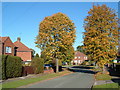

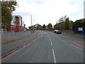
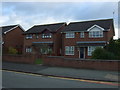
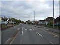
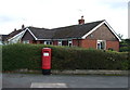
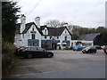
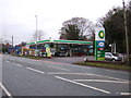
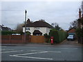
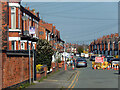
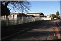
22 photos from this area
Area Information
Key information about the CW2 8AD including its size, population, and administrative classification.
- Area Type
- Postcode
- Area Size
- 2.6 hectares
- Population
- 1544
- Population Density
- 3848 people/km²
House Prices in CW2 8AD
27
Properties
£135,835
Average Sold Price
£47,152
Lowest Price
£290,000
Highest Price
Showing 27 properties
| Address | Type | Beds | Baths | Last Sale Price | Last Sale Date | |
|---|---|---|---|---|---|---|
| 82 Dane Bank Avenue, Crewe, CW2 8AD | Detached | 3 | 1 | £167,000 | Jan 2021 | |
| 64 Dane Bank Avenue, Crewe, CW2 8AD | Detached | 4 | 2 | £290,000 | Oct 2020 | |
| 80 Dane Bank Avenue, Crewe, CW2 8AD | house | 3 | - | £153,000 | Jan 2020 | |
| 54 Dane Bank Avenue, Crewe, CW2 8AD | Bungalow | 4 | 1 | £223,000 | Feb 2014 | |
| 46 Dane Bank Avenue, Crewe, CW2 8AD | Detached | - | - | £193,000 | Jan 2007 | |
| 68 Dane Bank Avenue, Crewe, CW2 8AD | Detached | 4 | 2 | £186,495 | Oct 2006 | |
| 74A Dane Bank Avenue, Crewe, CW2 8AD | house | - | - | £130,000 | Nov 2005 | |
| 72 Dane Bank Avenue, Crewe, CW2 8AD | house | - | - | £117,500 | Jul 2005 | |
| 70A Dane Bank Avenue, Crewe, CW2 8AD | house | 3 | - | £58,500 | Feb 2001 | |
| 42 Dane Bank Avenue, Crewe, CW2 8AD | Terraced | 2 | 1 | £98,500 | Jul 2000 |
Page 1 of 3
Energy Efficiency in CW2 8AD
Amenities
Schools
| Rank | School | Type | Entry gender | Ages |
|---|
Explore more schools in this area
Go to Schools tabDemographics
Household Size
Two person
most common
Accommodation Type
Houses
most common
Tenure
90
majority
Ethnic Group
White
most common
Religion
N/A
most common
Household Composition
N/A
most common
Age
47
median
Adults (30-64 years)
most common
Household Deprivation
N/A
with no deprivation
NS-SEC
32
in Lower managerial occupations
Explore more demographic insights in this area
Go to Demographics tabPlanning
Planning Constraints
- Flood RiskPremium
- Ramsar Wetland SitesPremium
- Area of Outstanding Natural BeautyPremium
- Protected Nature ReservePremium
- Protected WoodlandPremium