Area Overview for CW2 7DE
Photos of CW2 7DE
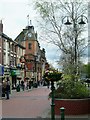
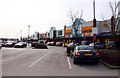
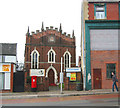
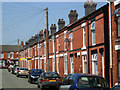
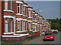
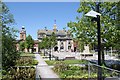
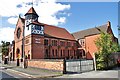
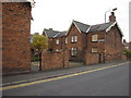
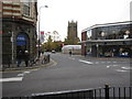
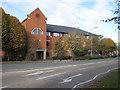
100 photos from this area
Area Information
Key information about the CW2 7DE including its size, population, and administrative classification.
- Area Type
- Postcode
- Area Size
- 6.6 hectares
- Population
- 1552
- Population Density
- 2124 people/km²
House Prices in CW2 7DE
16
Properties
£100,778
Average Sold Price
£64,000
Lowest Price
£135,000
Highest Price
Showing 16 properties
| Address | Type | Beds | Baths | Last Sale Price | Last Sale Date | |
|---|---|---|---|---|---|---|
| 7 Brook Street, Crewe, CW2 7DE | Terraced | 3 | 1 | £80,000 | Sep 2025 | |
| 9 Brook Street, Crewe, CW2 7DE | Terraced | 3 | 2 | £105,000 | Jan 2025 | |
| 11 Brook Street, Crewe, CW2 7DE | Terraced | 1 | 1 | £135,000 | Jun 2023 | |
| 21 Brook Street, Crewe, CW2 7DE | Semi-detached | 3 | 1 | £105,000 | May 2023 | |
| 15 Brook Street, Crewe, CW2 7DE | Terraced | 3 | - | £126,000 | Dec 2021 | |
| 19 Brook Street, Crewe, CW2 7DE | Terraced | 3 | 1 | £87,000 | Dec 2019 | |
| 5 Brook Street, Crewe, CW2 7DE | house | - | - | £125,000 | Nov 2019 | |
| 17 Brook Street, Crewe, CW2 7DE | Terraced | 3 | - | £80,000 | May 2010 | |
| 13 Brook Street, Crewe, CW2 7DE | Terraced | 3 | 2 | £64,000 | Apr 2004 | |
| First Floor, Mill House, Brook Street, Crewe, CW2 7DE | Office | - | - | - | - |
Page 1 of 2
Energy Efficiency in CW2 7DE
Amenities
Schools
| Rank | School | Type | Entry gender | Ages |
|---|
Explore more schools in this area
Go to Schools tabDemographics
Household Size
One person
most common
Accommodation Type
Houses
most common
Tenure
51
majority
Ethnic Group
White
most common
Religion
N/A
most common
Household Composition
N/A
most common
Age
47
median
Adults (30-64 years)
most common
Household Deprivation
N/A
with no deprivation
NS-SEC
17
in Lower managerial occupations
Explore more demographic insights in this area
Go to Demographics tabPlanning
Planning Constraints
- Flood RiskPremium
- Ramsar Wetland SitesPremium
- Area of Outstanding Natural BeautyPremium
- Protected Nature ReservePremium
- Protected WoodlandPremium