Area Overview for CW2 6HS
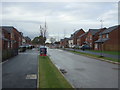
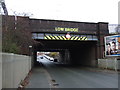
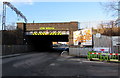
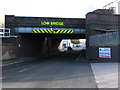
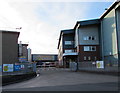
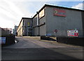
Photos of CW2 6HS


Area Information
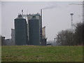
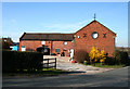
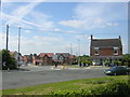
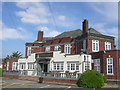
CW2 6HS is a compact postcode area in Cheshire East, England, encompassing a small residential cluster with a population of 1,939 people spread over 2,924 square metres. This density reflects a tightly knit community, though the area’s character is shaped by its proximity to Crewe town centre, just 1½ miles west. Historically, the region was part of the former civil parish of Crewe Green, now merged into Weston and Crewe Green. The landscape blends residential homes, farms at Slaughter Hill, and industrial estates like Crewe Hall Enterprise Park. Notable landmarks include the grade-I-listed Crewe Hall, a Jacobean mansion now used as a hotel, and 201 hectares of grade II-listed parkland. Daily life here balances rural tranquillity with urban access, with residents able to reach Crewe’s amenities quickly. The area’s mix of historical sites, green spaces, and transport links makes it appealing for those seeking a blend of heritage and practicality.
- Area Type
- Postcode
- Area Size
- 2924 m²
- Population
- 1939
- Population Density
- 2680 people/km²
The property market in CW2 6HS is characterised by a 36% home ownership rate, indicating that more than two-thirds of residents rent their homes. This suggests a rental market that may be influenced by the area’s proximity to Crewe’s employment hubs or its appeal to commuters. The accommodation type is predominantly houses, which contrasts with areas dominated by flats or apartments. Given the small size of the postcode area and its integration with surrounding industrial and residential zones, property availability is likely limited. Buyers should consider the balance between owner-occupied and rental properties, as well as the potential for investment in a historically significant area with green spaces. The mix of homes and industrial estates may also affect property values, with proximity to Crewe Hall and other landmarks adding character but not necessarily driving up prices.
House Prices in CW2 6HS
Showing 2 properties
| Address | Type | Beds | Baths | Last Sale Price | Last Sale Date | |
|---|---|---|---|---|---|---|
| P W Shops Yard, Gresty Road, Crewe, CW2 6HS | Semi-detached | 3 | 1 | - | - | |
| Carillion Rail Projects, 219 Gresty Road, Crewe, CW2 6HS | office_workshop | - | - | - | - |
Energy Efficiency in CW2 6HS
Living in CW2 6HS offers access to a range of amenities within practical reach. Retail options include Aldi Wistaston, Morrisons Daily, and Tesco Crewe, providing everyday shopping convenience. The area’s proximity to Crewe town centre and nearby railway stations enhances its appeal for those seeking urban amenities without sacrificing rural tranquillity. For leisure, the 201 hectares of grade II-listed parkland, including Rookery Wood and Temple of Peace Wood, offer walking and recreational opportunities. The Crewe and Nantwich Circular Walk runs through the area, adding to its appeal for outdoor enthusiasts. The presence of historical sites like St Michael and All Angels Church and Crewe Hall further enriches the local character, blending heritage with modern convenience.
Amenities
Schools
| Rank | School | Type | Entry gender | Ages |
|---|
Explore more schools in this area
Go to Schools tabDemographics
The population of CW2 6HS has a median age of 47, with the majority of residents aged between 30 and 64. This suggests a community of established adults, many of whom may be in their prime working years. Home ownership in the area stands at 36%, indicating a significant proportion of residents rent their homes. The predominant accommodation type is houses, which aligns with the area’s residential character. The population density of 663,152 people per square kilometre is exceptionally high, reflecting a tightly packed living environment. While the predominant ethnic group is White, no specific data on diversity or deprivation levels is provided. This density may influence local dynamics, such as shared community spaces and reliance on nearby amenities. The age profile suggests a stable demographic, though the lack of younger residents could impact long-term growth or family-oriented services.
Household Size
Accommodation Type
Tenure
Ethnic Group
Religion
Household Composition
Age
Household Deprivation
NS-SEC
Explore more demographic insights in this area
Go to Demographics tabPlanning
Planning Constraints
- Flood RiskPremium
- Ramsar Wetland SitesPremium
- Area of Outstanding Natural BeautyPremium
- Protected Nature ReservePremium
- Protected WoodlandPremium