Area Overview for CW2 6DL
Photos of CW2 6DL
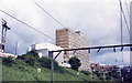
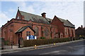
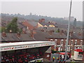
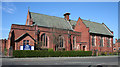
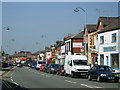
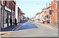
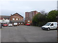
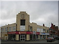
100 photos from this area
Area Information
Key information about the CW2 6DL including its size, population, and administrative classification.
- Area Type
- Postcode
- Area Size
- 5460 m²
- Population
- 1966
- Population Density
- 9313 people/km²
House Prices in CW2 6DL
32
Properties
£88,526
Average Sold Price
£32,500
Lowest Price
£130,000
Highest Price
Showing 32 properties
| Address | Type | Beds | Baths | Last Sale Price | Last Sale Date | |
|---|---|---|---|---|---|---|
| 23 Madeley Street, Crewe, CW2 6DL | Terraced | 3 | 1 | £120,000 | Feb 2025 | |
| 3 Madeley Street, Crewe, CW2 6DL | Terraced | 3 | 1 | £127,500 | Mar 2022 | |
| 6 Madeley Street, Crewe, CW2 6DL | house | - | - | £95,000 | Mar 2022 | |
| 21 Madeley Street, Crewe, CW2 6DL | house | - | - | £115,000 | Nov 2020 | |
| 17 Madeley Street, Crewe, CW2 6DL | Terraced | 3 | 1 | £117,000 | Oct 2019 | |
| 27 Madeley Street, Crewe, CW2 6DL | house | - | - | £109,950 | Jul 2018 | |
| 39 Madeley Street, Crewe, CW2 6DL | Terraced | 3 | 1 | £117,000 | Jul 2018 | |
| 45 Madeley Street, Crewe, CW2 6DL | Terraced | 3 | 1 | £110,000 | Nov 2016 | |
| 35 Madeley Street, Crewe, CW2 6DL | Terraced | 3 | 1 | £87,500 | Oct 2015 | |
| 41 Madeley Street, Crewe, CW2 6DL | Terraced | 2 | 1 | £82,100 | Oct 2013 |
Page 1 of 4
Energy Efficiency in CW2 6DL
Amenities
Schools
| Rank | School | Type | Entry gender | Ages |
|---|
Explore more schools in this area
Go to Schools tabDemographics
Household Size
Family (3-5 people)
most common
Accommodation Type
Houses
most common
Tenure
36
majority
Ethnic Group
White
most common
Religion
N/A
most common
Household Composition
N/A
most common
Age
47
median
Adults (30-64 years)
most common
Household Deprivation
N/A
with no deprivation
NS-SEC
15
in Lower managerial occupations
Explore more demographic insights in this area
Go to Demographics tabPlanning
Planning Constraints
- Flood RiskPremium
- Ramsar Wetland SitesPremium
- Area of Outstanding Natural BeautyPremium
- Protected Nature ReservePremium
- Protected WoodlandPremium