Area Overview for CW12 4WL
Photos of CW12 4WL
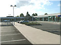
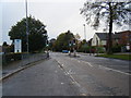
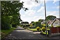
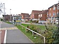
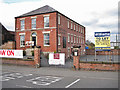
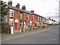
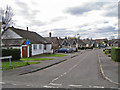

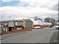


26 photos from this area
Area Information
Key information about the CW12 4WL including its size, population, and administrative classification.
- Area Type
- Postcode
- Area Size
- 9331 m²
- Population
- Not available
- Population Density
- Not available
House Prices in CW12 4WL
33
Properties
£141,977
Average Sold Price
£62,965
Lowest Price
£405,000
Highest Price
Showing 33 properties
| Address | Type | Beds | Baths | Last Sale Price | Last Sale Date | |
|---|---|---|---|---|---|---|
| 22 Parker Way, Congleton, CW12 4WL | Maisonette | 1 | 1 | £84,000 | Dec 2024 | |
| 23 Parker Way, Congleton, CW12 4WL | Semi-detached | 3 | 1 | £168,000 | Sep 2024 | |
| 12 Parker Way, Congleton, CW12 4WL | Semi-detached | 4 | 2 | £405,000 | Aug 2023 | |
| 44 Parker Way, Congleton, CW12 4WL | Terraced | 2 | 1 | £139,300 | Aug 2023 | |
| 34 Parker Way, Congleton, CW12 4WL | Semi-detached | 4 | 1 | £260,000 | Aug 2023 | |
| 28 Parker Way, Congleton, CW12 4WL | Terraced | 3 | 1 | £115,500 | Mar 2021 | |
| 8 Parker Way, Congleton, CW12 4WL | Semi-detached | 3 | - | £215,000 | Dec 2020 | |
| 24 Parker Way, Congleton, CW12 4WL | Terraced | 3 | - | £133,000 | Oct 2020 | |
| 20 Parker Way, Congleton, CW12 4WL | Detached | 4 | - | £105,000 | Jun 2019 | |
| 18 Parker Way, Congleton, CW12 4WL | Terraced | 2 | 1 | £84,000 | Dec 2018 |
Page 1 of 4
Energy Efficiency in CW12 4WL
Amenities
Schools
| Rank | School | Type | Entry gender | Ages |
|---|
Explore more schools in this area
Go to Schools tabDemographics
Household Size
One person
most common
Accommodation Type
Houses
most common
Tenure
78
majority
Ethnic Group
White
most common
Religion
N/A
most common
Household Composition
N/A
most common
Age
47
median
Adults (30-64 years)
most common
Household Deprivation
N/A
with no deprivation
NS-SEC
34
in Lower managerial occupations
Explore more demographic insights in this area
Go to Demographics tabPlanning
Planning Constraints
- Flood RiskPremium
- Ramsar Wetland SitesPremium
- Area of Outstanding Natural BeautyPremium
- Protected Nature ReservePremium
- Protected WoodlandPremium