Area Overview for CW12 4UG
Photos of CW12 4UG
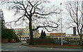
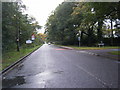
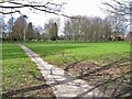
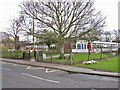
14 photos from this area
Area Information
Key information about the CW12 4UG including its size, population, and administrative classification.
- Area Type
- Postcode
- Area Size
- 2.4 hectares
- Population
- 2213
- Population Density
- 142 people/km²
House Prices in CW12 4UG
35
Properties
£627,649
Average Sold Price
£21,799
Lowest Price
£12,600,000
Highest Price
Showing 35 properties
| Address | Type | Beds | Baths | Last Sale Price | Last Sale Date | |
|---|---|---|---|---|---|---|
| 68 Field View Road, Congleton, CW12 4UG | Semi-detached | 3 | 2 | £255,000 | Aug 2025 | |
| 32 Field View Road, Congleton, CW12 4UG | Semi-detached | 3 | 2 | £252,500 | Apr 2025 | |
| 50 Field View Road, Congleton, CW12 4UG | Semi-detached | 4 | 2 | £280,000 | Mar 2025 | |
| 46 Field View Road, Congleton, CW12 4UG | house | - | - | £285,000 | Jan 2025 | |
| 62 Field View Road, Congleton, CW12 4UG | Semi-detached | 2 | 1 | £185,000 | Aug 2024 | |
| 44 Field View Road, Congleton, CW12 4UG | Detached | 3 | 2 | £350,000 | May 2024 | |
| 30 Field View Road, Congleton, CW12 4UG | Terraced | 3 | 2 | £242,500 | Aug 2023 | |
| 24 Field View Road, Congleton, CW12 4UG | house | - | - | £110,000 | Aug 2023 | |
| 58 Field View Road, Congleton, CW12 4UG | house | 3 | 2 | £248,000 | Nov 2022 | |
| 70 Field View Road, Congleton, CW12 4UG | Terraced | 2 | 1 | £152,500 | Sep 2021 |
Page 1 of 4
Energy Efficiency in CW12 4UG
Amenities
Schools
| Rank | School | Type | Entry gender | Ages |
|---|
Explore more schools in this area
Go to Schools tabDemographics
Household Size
Family (3-5 people)
most common
Accommodation Type
Houses
most common
Tenure
79
majority
Ethnic Group
White
most common
Religion
N/A
most common
Household Composition
N/A
most common
Age
47
median
Adults (30-64 years)
most common
Household Deprivation
N/A
with no deprivation
NS-SEC
47
in Lower managerial occupations
Explore more demographic insights in this area
Go to Demographics tabPlanning
Planning Constraints
- Flood RiskPremium
- Ramsar Wetland SitesPremium
- Area of Outstanding Natural BeautyPremium
- Protected Nature ReservePremium
- Protected WoodlandPremium