Area Overview for CW12 4BN
Photos of CW12 4BN
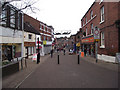
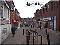
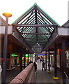
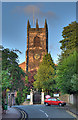
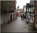
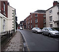

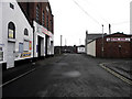
75 photos from this area
Area Information
Key information about the CW12 4BN including its size, population, and administrative classification.
- Area Type
- Postcode
- Area Size
- 5584 m²
- Population
- 1446
- Population Density
- 3454 people/km²
House Prices in CW12 4BN
32
Properties
£97,319
Average Sold Price
£17,500
Lowest Price
£173,000
Highest Price
Showing 32 properties
| Address | Type | Beds | Baths | Last Sale Price | Last Sale Date | |
|---|---|---|---|---|---|---|
| 37 Swan Street, Congleton, CW12 4BN | Terraced | 2 | 1 | £158,000 | Oct 2025 | |
| 19 Swan Street, Congleton, CW12 4BN | Terraced | 2 | 1 | £105,000 | Aug 2025 | |
| 59 Swan Street, Congleton, CW12 4BN | Terraced | 2 | 1 | £173,000 | May 2025 | |
| 31 Swan Street, Congleton, CW12 4BN | Terraced | 2 | 1 | £125,000 | Jan 2024 | |
| 13 Swan Street, Congleton, CW12 4BN | house | - | - | £85,000 | Sep 2022 | |
| 27 Swan Street, Congleton, CW12 4BN | house | - | - | £124,000 | Nov 2021 | |
| 25 Swan Street, Congleton, CW12 4BN | house | - | - | £86,000 | Oct 2021 | |
| 17 Swan Street, Congleton, CW12 4BN | house | - | - | £120,000 | Jul 2021 | |
| 21 Swan Street, Congleton, CW12 4BN | Terraced | 2 | 1 | £118,000 | Mar 2021 | |
| 55 Swan Street, Congleton, CW12 4BN | Terraced | 2 | 1 | £143,000 | Jan 2021 |
Page 1 of 4
Energy Efficiency in CW12 4BN
Amenities
Schools
| Rank | School | Type | Entry gender | Ages |
|---|
Explore more schools in this area
Go to Schools tabDemographics
Household Size
One person
most common
Accommodation Type
Houses
most common
Tenure
54
majority
Ethnic Group
White
most common
Religion
N/A
most common
Household Composition
N/A
most common
Age
47
median
Adults (30-64 years)
most common
Household Deprivation
N/A
with no deprivation
NS-SEC
28
in Lower managerial occupations
Explore more demographic insights in this area
Go to Demographics tabPlanning
Planning Constraints
- Flood RiskPremium
- Ramsar Wetland SitesPremium
- Area of Outstanding Natural BeautyPremium
- Protected Nature ReservePremium
- Protected WoodlandPremium