Area Overview for CW12 3EP
Photos of CW12 3EP
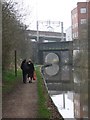
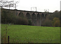
96 photos from this area
Area Information
Key information about the CW12 3EP including its size, population, and administrative classification.
- Area Type
- Postcode
- Area Size
- 1.8 hectares
- Population
- 1657
- Population Density
- 4007 people/km²
House Prices in CW12 3EP
59
Properties
£88,634
Average Sold Price
£20,065
Lowest Price
£182,250
Highest Price
Showing 59 properties
| Address | Type | Beds | Baths | Last Sale Price | Last Sale Date | |
|---|---|---|---|---|---|---|
| 99 Dale Crescent, Congleton, CW12 3EP | Terraced | 3 | 1 | £150,000 | Apr 2025 | |
| 78 Dale Crescent, Congleton, CW12 3EP | house | 3 | - | £182,250 | Jan 2023 | |
| 74 Dale Crescent, Congleton, CW12 3EP | Semi-detached | 3 | 1 | £105,000 | Jul 2019 | |
| 89 Dale Crescent, Congleton, CW12 3EP | house | 3 | 1 | £89,950 | Dec 2015 | |
| 40 Dale Crescent, Congleton, CW12 3EP | house | - | - | £77,500 | Oct 2015 | |
| 65 Dale Crescent, Congleton, CW12 3EP | house | - | - | £98,000 | Mar 2010 | |
| 57 Dale Crescent, Congleton, CW12 3EP | house | 3 | 2 | £102,150 | May 2008 | |
| 87 Dale Crescent, Congleton, CW12 3EP | Terraced | - | - | £98,000 | Sep 2006 | |
| 93 Dale Crescent, Congleton, CW12 3EP | house | - | - | £20,065 | Apr 2002 | |
| 121 Dale Crescent, Congleton, CW12 3EP | Terraced | - | - | £21,060 | Nov 2001 |
Page 1 of 6
Energy Efficiency in CW12 3EP
Amenities
Schools
| Rank | School | Type | Entry gender | Ages |
|---|
Explore more schools in this area
Go to Schools tabDemographics
Household Size
Family (3-5 people)
most common
Accommodation Type
Houses
most common
Tenure
64
majority
Ethnic Group
White
most common
Religion
N/A
most common
Household Composition
N/A
most common
Age
47
median
Adults (30-64 years)
most common
Household Deprivation
N/A
with no deprivation
NS-SEC
28
in Lower managerial occupations
Explore more demographic insights in this area
Go to Demographics tabPlanning
Planning Constraints
- Flood RiskPremium
- Ramsar Wetland SitesPremium
- Area of Outstanding Natural BeautyPremium
- Protected Nature ReservePremium
- Protected WoodlandPremium