Area Overview for CW12 3AT
Photos of CW12 3AT
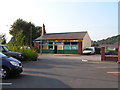
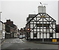
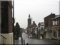
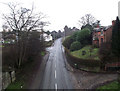


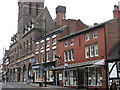
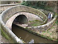
92 photos from this area
Area Information
Key information about the CW12 3AT including its size, population, and administrative classification.
- Area Type
- Postcode
- Area Size
- 1.7 hectares
- Population
- 1519
- Population Density
- 1768 people/km²
House Prices in CW12 3AT
27
Properties
£149,354
Average Sold Price
£80,000
Lowest Price
£320,000
Highest Price
Showing 27 properties
| Address | Type | Beds | Baths | Last Sale Price | Last Sale Date | |
|---|---|---|---|---|---|---|
| 149 Canal Road, Congleton, CW12 3AT | house | - | - | £103,000 | Feb 2025 | |
| 151 Canal Road, Congleton, CW12 3AT | Terraced | 2 | 1 | £168,000 | Mar 2023 | |
| 137-139 Canal Road, Congleton, CW12 3AT | house | 3 | 1 | £160,000 | May 2020 | |
| 143 Canal Road, Congleton, CW12 3AT | Terraced | 2 | 1 | £91,000 | Jul 2016 | |
| 141 Canal Road, Congleton, CW12 3AT | Terraced | 2 | 1 | £115,000 | Jul 2015 | |
| 145 Canal Road, Congleton, CW12 3AT | house | - | - | £112,250 | Aug 2012 | |
| 147 Canal Road, Congleton, CW12 3AT | Terraced | 2 | 1 | £105,000 | Feb 2010 | |
| 128 Canal Road, Congleton, CW12 3AT | Detached | - | - | £213,000 | Nov 2006 | |
| Grange Cottage, 150 Canal Road, Congleton, CW12 3AT | Detached | 3 | 2 | £320,000 | Apr 2006 | |
| Field Bank, 138 Canal Road, Congleton, CW12 3AT | Semi-detached | - | - | £162,500 | May 2004 |
Page 1 of 3
Energy Efficiency in CW12 3AT
Amenities
Schools
| Rank | School | Type | Entry gender | Ages |
|---|
Explore more schools in this area
Go to Schools tabDemographics
Household Size
Two person
most common
Accommodation Type
Houses
most common
Tenure
92
majority
Ethnic Group
White
most common
Religion
N/A
most common
Household Composition
N/A
most common
Age
47
median
Adults (30-64 years)
most common
Household Deprivation
N/A
with no deprivation
NS-SEC
46
in Lower managerial occupations
Explore more demographic insights in this area
Go to Demographics tabPlanning
Planning Constraints
- Flood RiskPremium
- Ramsar Wetland SitesPremium
- Area of Outstanding Natural BeautyPremium
- Protected Nature ReservePremium
- Protected WoodlandPremium