Area Overview for CW12 2JW
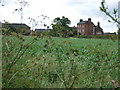
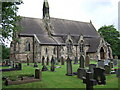
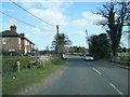
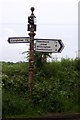
Photos of CW12 2JW
Area Information
Living in CW12 2JW means being part of a small, tightly knit residential cluster in Cheshire East, England. With a population of 2,213 and a density of 142 people per square kilometre, this area balances rural tranquillity with practical connectivity. The postcode lies near Somerford Booths, a civil parish marked by scattered farms, historic buildings like Somerford Booths Hall, and the hamlet of Newsbank. Daily life here is shaped by its proximity to nearby towns and its integration with the surrounding countryside. Residents benefit from access to four railway stations within practical reach, including Congleton and Holmes Chapel, linking them to regional hubs. The area’s charm lies in its low population density, which avoids urban congestion, while its proximity to retail spots like Aldi and M&S Congleton ensures convenience. This is a place for those seeking a quieter lifestyle, with a strong sense of community and a foundation of historic character.
- Area Type
- Postcode
- Area Size
- Not available
- Population
- 2213
- Population Density
- 142 people/km²
The property market in CW12 2JW is characterised by a high rate of home ownership (79%), indicating a community of long-term residents rather than a transient rental market. The area is predominantly composed of houses, which suggests a focus on larger, family-oriented properties rather than smaller units. This aligns with the postcode’s low population density, as houses typically accommodate more occupants per property. For buyers, this means a market skewed towards owner-occupied homes, with fewer opportunities for short-term lettings or investment properties. The small size of the area means that properties are likely to be spread out, requiring buyers to consider commuting distances. However, the presence of nearby railway stations, such as Congleton and Holmes Chapel, provides access to regional employment centres, balancing the rural setting with urban connectivity.
House Prices in CW12 2JW
No properties found in this postcode.
Energy Efficiency in CW12 2JW
The lifestyle in CW12 2JW is defined by its blend of rural tranquillity and accessible amenities. Within practical reach are five retail spots, including Aldi on Albion Road, Farmfoods Congleton, and M&S Congleton, offering everyday shopping needs. The area’s proximity to four railway stations—Congleton, Goostrey, and Holmes Chapel—ensures easy access to nearby towns and cultural hubs. While the postcode itself is small, the surrounding region features historic sites like Somerford Booths Hall and ancient farms such as Grove House and Broomfield Farm, adding to the area’s character. This mix of practical retail, transport options, and historic surroundings creates a lifestyle that balances convenience with a connection to the past. Residents can enjoy a peaceful environment while maintaining links to regional amenities.
Amenities
Schools
| Rank | School | Type | Entry gender | Ages |
|---|
Explore more schools in this area
Go to Schools tabDemographics
CW12 2JW has a median age of 47, with the majority of residents aged 30–64. This suggests a mature, stable community, likely with established families and professionals. Home ownership is high at 79%, indicating a preference for long-term residency over rental properties. The area is predominantly composed of houses, reflecting a focus on family homes rather than flats or apartments. The predominant ethnic group is White, aligning with broader regional demographics. While specific data on deprivation is not provided, the high home ownership rate and low population density imply a relatively affluent, low-pressure environment. The age profile suggests a mix of middle-aged professionals and retirees, contributing to a balanced community dynamic. This demographic structure supports a lifestyle prioritising stability, with limited pressure on local services compared to more densely populated areas.
Household Size
Accommodation Type
Tenure
Ethnic Group
Religion
Household Composition
Age
Household Deprivation
NS-SEC
Explore more demographic insights in this area
Go to Demographics tabPlanning
Planning Constraints
- Flood RiskPremium
- Ramsar Wetland SitesPremium
- Area of Outstanding Natural BeautyPremium
- Protected Nature ReservePremium
- Protected WoodlandPremium