Area Overview for CW12 2HF
Photos of CW12 2HF
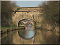
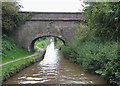
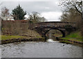

33 photos from this area
Area Information
Key information about the CW12 2HF including its size, population, and administrative classification.
- Area Type
- Postcode
- Area Size
- 15.8 hectares
- Population
- 1950
- Population Density
- 455 people/km²
House Prices in CW12 2HF
38
Properties
£176,756
Average Sold Price
£45,700
Lowest Price
£320,000
Highest Price
Showing 38 properties
| Address | Type | Beds | Baths | Last Sale Price | Last Sale Date | |
|---|---|---|---|---|---|---|
| 71 Bath Vale, Congleton, CW12 2HF | house | 2 | 1 | £76,000 | Mar 2025 | |
| 81 Bath Vale, Congleton, CW12 2HF | Semi-detached | 2 | 1 | £159,000 | Dec 2024 | |
| 67 Bath Vale, Congleton, CW12 2HF | house | 2 | 1 | £90,000 | Jul 2024 | |
| 83 Bath Vale, Congleton, CW12 2HF | Terraced | 2 | 1 | £163,500 | Jan 2022 | |
| 65 Bath Vale, Congleton, CW12 2HF | Terraced | 2 | 1 | £127,500 | Aug 2021 | |
| 63 Bath Vale, Congleton, CW12 2HF | Detached | 5 | 3 | £300,000 | Oct 2020 | |
| 75 Bath Vale, Congleton, CW12 2HF | Terraced | 2 | 1 | £150,000 | Dec 2019 | |
| 103 Bath Vale, Congleton, CW12 2HF | house | - | - | £240,000 | Jun 2019 | |
| 105 Bath Vale, Congleton, CW12 2HF | Flat | - | - | £140,000 | Mar 2019 | |
| 85 Bath Vale, Congleton, CW12 2HF | Terraced | 2 | 1 | £119,995 | Mar 2019 |
Page 1 of 4
Energy Efficiency in CW12 2HF
Amenities
Schools
| Rank | School | Type | Entry gender | Ages |
|---|
Explore more schools in this area
Go to Schools tabDemographics
Household Size
Two person
most common
Accommodation Type
Houses
most common
Tenure
80
majority
Ethnic Group
White
most common
Religion
N/A
most common
Household Composition
N/A
most common
Age
47
median
Adults (30-64 years)
most common
Household Deprivation
N/A
with no deprivation
NS-SEC
39
in Lower managerial occupations
Explore more demographic insights in this area
Go to Demographics tabPlanning
Planning Constraints
- Flood RiskPremium
- Ramsar Wetland SitesPremium
- Area of Outstanding Natural BeautyPremium
- Protected Nature ReservePremium
- Protected WoodlandPremium