Area Overview for CW12 2FD
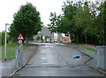
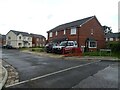
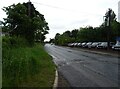
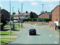
Photos of CW12 2FD


Area Information
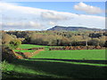
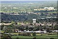
CW12 2FD is a small, residential postcode area in Cheshire, England, with a population of 1919 and a low population density of 49 people per square kilometre. It lies within the historic township of Eaton, now merged into surrounding parishes, and is near Eaton Hall, the estate of the Duke of Westminster. The area retains a rural character, with a mix of traditional architecture and modern infrastructure. Daily life here is shaped by its proximity to local amenities and transport links, though its small size means it is more subdued than larger towns. The community is largely composed of adults aged 30–64, with a strong presence of home ownership. Residents benefit from a quiet, low-density environment, with access to nearby primary schools and rail connections. The area’s historical roots, including 18th-century industrial sites and listed buildings, add to its distinct identity. For those seeking a peaceful, family-oriented neighbourhood with a touch of heritage, CW12 2FD offers a blend of practicality and character.
- Area Type
- Postcode
- Area Size
- Not available
- Population
- 1919
- Population Density
- 49 people/km²
The property market in CW12 2FD is dominated by owner-occupied homes, with 73% of residents owning their properties. This high level of home ownership suggests a stable, long-term community with limited turnover. The accommodation type is primarily houses, which is typical for rural or semi-rural areas with lower population density. This contrasts with urban centres where flats or apartments are more common. The small size of the postcode area means the housing stock is limited, making it a niche market for buyers seeking a quiet, low-density environment. The focus on houses may appeal to families or individuals prioritising space and privacy. However, the lack of data on property prices or recent sales means the market’s competitiveness is unclear. Buyers should consider the area’s proximity to amenities and transport links, which are critical for long-term value in such a small, specialised postcode.
House Prices in CW12 2FD
No properties found in this postcode.
Energy Efficiency in CW12 2FD
Living in CW12 2FD offers access to a range of local amenities within practical reach. Retail options include Morrisons Daily Buglawton, M&S Congleton SF, and Co-op Bromley, providing essential shopping and services. These stores cater to daily needs, from groceries to household items. The area’s proximity to rail stations, such as Congleton and Goostrey, enhances connectivity to larger towns and cities, supporting both work and leisure travel. While the data does not list parks or leisure facilities explicitly, the low population density and historical context suggest a balance between rural tranquillity and community hubs. The presence of nearby schools and retail centres indicates a functional, self-contained lifestyle, though residents may need to venture further for more specialised amenities. The combination of practical retail access and transport links makes CW12 2FD suitable for those valuing convenience without urban density.
Amenities
Schools
The nearest school to CW12 2FD is Marton and District CofE Aided Primary School, a primary school with an Ofsted rating of ‘good’. This school serves the local community and is likely a key factor for families considering the area. The absence of secondary schools nearby means residents may need to travel to adjacent towns for secondary education, but the primary school’s quality provides a solid foundation for younger children. The single school listed suggests a modest educational infrastructure, which may be sufficient for small families but less convenient for those requiring multiple school options. For buyers prioritising schools, the ‘good’ rating at Marton and District CofE Aided Primary School is a positive indicator, though broader educational needs may require planning for commuting.
| Rank | School | Type | Entry gender | Ages |
|---|
Explore more schools in this area
Go to Schools tabDemographics
The population of CW12 2FD is predominantly adults aged 30–64, with a median age of 47. This suggests a mature, stable community with a focus on long-term residency. Home ownership is high, at 73%, indicating a strong presence of owner-occupied properties rather than rental housing. The accommodation type is primarily houses, which aligns with the area’s lower population density and rural character. The predominant ethnic group is White, reflecting the broader demographic patterns of the region. While specific data on deprivation is not provided, the low population density and high home ownership suggest a relatively stable economic profile. The absence of significant diversity data means the community is likely homogeneous, though this does not necessarily indicate a lack of inclusivity. For families or individuals seeking a settled, low-maintenance lifestyle, the demographic profile of CW12 2FD aligns with practical, long-term living.
Household Size
Accommodation Type
Tenure
Ethnic Group
Religion
Household Composition
Age
Household Deprivation
NS-SEC
Explore more demographic insights in this area
Go to Demographics tabPlanning
Planning Constraints
- Flood RiskPremium
- Ramsar Wetland SitesPremium
- Area of Outstanding Natural BeautyPremium
- Protected Nature ReservePremium
- Protected WoodlandPremium